Dakingari geodata
Dakingari (Kebbi) is a seat of a second-order administrative division; located in Nigeria in Africa/Lagos (GMT+1) time zone. With population of 12,558 people, there are 287 cities with bigger population in this country. Compared to other cities in Nigeria, 79.2% of cities are located further ↓South; 91.6% of cities are located further →East and 62.5% of cities have higher elevation than Dakingari. Note1


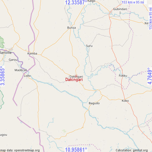
Dakingari GPS coordinates[2]
11° 38' 53.124" North, 4° 3' 42.372" East
| Map corner | latitude | longitude |
|---|---|---|
| Upper-left | 12.33587°, | 3.35865° |
| Center: | 11.64809°, | 4.06177° |
| Lower-right: | 10.95861°, | 4.7649° |
| Map W x H: | 153.1×153.1 km | = 95.1×95.1mi |
| max Lat: | 13.7543° ⇑20.8% North |
| Dakingari: | 11.64809° |
| min Lat: | ⇓79.2% South 4.31231° |
| min Long | Dakingari | max Long |
| 2.73333° | 4.06177° | 14.46552° |
| W 8.4%⇐ | ⇒91.6% E |
Elevation
Elevation of Dakingari is 191 m = 627 ft, and this is 105.5 m = 346 ft below average elevation for this country.
| Max E: |
1599 m = 5246 ft | 62.5% |
| Avg. | 296.5 m = 973 ft | |
| Dakingari | 191 m = 627 ft | |
Min E: |
2 m = 7 ft | 37.5% |
See also: Nigeria elevation on elevation.city.
Geographical zone
Dakingari is located in North Torrid zone (between Equator and Tropic of Cancer). Distance of Equator is 1295.1 km =804.7 mi to South.| Distance of | km | miles | from Dakingari |
|---|---|---|---|
| North Pole | 8711.9 | 5413.3 | to North |
| Arctic Circle | 6106 | 3794.1 | to North |
| Tropic Cancer | 1310.8 | 814.5 | to North |
| Equator | 1295.1 | 804.7 | to South |


Nearby cities:
15 places around Dakingari: (largest is in red/bold)
• Aliero
84 km =52.2 mi,  32°
32°
• Bagudo
32.5 km =20.2 mi,  146°
146°
• Besse
58.5 km =36.4 mi,  136°
136°
• Birnin Kebbi
90.8 km =56.4 mi,  9°
9°
• Bunza
49.2 km =30.6 mi,  354°
354°
• Duku
102.9 km =63.9 mi,  116°
116°
• Jega
72.7 km =45.2 mi, 28°
• Kalgo
76.9 km =47.8 mi, 11°
• Kamba
49.8 km =30.9 mi,  297°
297°
• Kebbe
90.6 km =56.3 mi,  53°
53°
• Kende
25.9 km =16.1 mi, 123°
• Konkwesso
89.2 km =55.4 mi,  177°
177°
• Mahuta
100.7 km =62.6 mi,  96°
96°
• Maiyama
58.7 km =36.5 mi, 34°
• Shanga
74.3 km =46.2 mi,  130°
130°
Sources, notices
• [Note1] Compared only with cities in Nigeria existing in our database
• [Src1] Map data: © OpenStreetMap contributors (CC-BY-SA)
• [Src2] Other city data from geonames.org with taken over terms of usage.
• [Src3] Geographical zone / Annual Mean Temperature by Robert A. Rohde @ Wikipedia
