Zonkwa geodata
Zonkwa (Kaduna) is a seat of a second-order administrative division; located in Nigeria in Africa/Lagos (GMT+1) time zone. In our database, there are 451 cities with bigger population. Compared to other cities in Nigeria, 62.1% of cities are located further ↓South; 68.6% of cities are located further ←West and 98.2% of cities have lower elevation than Zonkwa. Note1


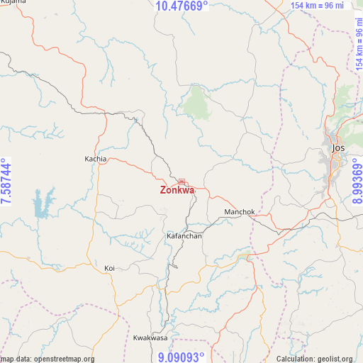
Zonkwa GPS coordinates[2]
9° 47' 4.308" North, 8° 17' 26.016" East
| Map corner | latitude | longitude |
|---|---|---|
| Upper-left | 10.47669°, | 7.58744° |
| Center: | 9.78453°, | 8.29056° |
| Lower-right: | 9.09093°, | 8.99369° |
| Map W x H: | 154.1×154.1 km | = 95.8×95.8mi |
| max Lat: | 13.7543° ⇑37.9% North |
| Zonkwa: | 9.78453° |
| min Lat: | ⇓62.1% South 4.31231° |
| min Long | Zonkwa | max Long |
| 2.73333° | 8.29056° | 14.46552° |
| W 68.6%⇐ | ⇒31.4% E |
Elevation
Elevation of Zonkwa is 859 m = 2818 ft, and this is 562.5 m = 1845 ft above average elevation for this country.
| Max E: |
1599 m = 5246 ft | 1.8% |
| Zonkwa | 859 m 2818 ft | |
| Avg. | 296.5 m = 973 ft | |
Min E: |
2 m = 7 ft | 98.2% |
See also: Nigeria elevation on elevation.city.
Geographical zone
Zonkwa is located in North Torrid zone (between Equator and Tropic of Cancer). Distance of Equator is 1087.9 km =676 mi to South.| Distance of | km | miles | from Zonkwa |
|---|---|---|---|
| North Pole | 8919.1 | 5542.1 | to North |
| Arctic Circle | 6313.2 | 3922.8 | to North |
| Tropic Cancer | 1518 | 943.2 | to North |
| Equator | 1087.9 | 676 | to South |


Nearby cities:
15 places around Zonkwa: (largest is in red/bold)
• Barkin Ladi
71.5 km =44.4 mi,  112°
112°
• Bassa
52.3 km =32.5 mi,  70°
70°
• Bukuru
62.8 km =39 mi,  89°
89°
• Gwantu
64.4 km =40 mi,  163°
163°
• Jos
67.8 km =42.1 mi,  76°
76°
• Kachia
38.2 km =23.7 mi,  285°
285°
• Kafanchan
22.6 km =14 mi,  179°
179°
• Kagarko
72.7 km =45.2 mi,  243°
243°
• Kagoro
22.5 km =14 mi,  150°
150°
• Kaura
22.5 km =14 mi,  125°
125°
• Kwoi
47.9 km =29.8 mi,  220°
220°
• Lere
73.7 km =45.8 mi,  24°
24°
• Riyom
53.7 km =33.4 mi, 107°
• Saminaka
82.2 km =51.1 mi,  31°
31°
• Vom
55.2 km =34.3 mi,  96°
96°
Sources, notices
• [Note1] Compared only with cities in Nigeria existing in our database
• [Src1] Map data: © OpenStreetMap contributors (CC-BY-SA)
• [Src2] Other city data from geonames.org with taken over terms of usage.
• [Src3] Geographical zone / Annual Mean Temperature by Robert A. Rohde @ Wikipedia
