Kaura geodata
Kaura (Kaduna) is a seat of a second-order administrative division; located in Nigeria in Africa/Lagos (GMT+1) time zone. In our database, there are 451 cities with bigger population. Compared to other cities in Nigeria, 61% of cities are located further ↓South; 71% of cities are located further ←West and 98.7% of cities have lower elevation than Kaura. Note1


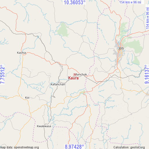
Kaura GPS coordinates[2]
9° 40' 5.232" North, 8° 27' 29.7" East
| Map corner | latitude | longitude |
|---|---|---|
| Upper-left | 10.36053°, | 7.75512° |
| Center: | 9.66812°, | 8.45825° |
| Lower-right: | 8.97428°, | 9.16137° |
| Map W x H: | 154.1×154.1 km | = 95.8×95.8mi |
| max Lat: | 13.7543° ⇑39% North |
| Kaura: | 9.66812° |
| min Lat: | ⇓61% South 4.31231° |
| min Long | Kaura | max Long |
| 2.73333° | 8.45825° | 14.46552° |
| W 71%⇐ | ⇒29% E |
Elevation
Elevation of Kaura is 968 m = 3176 ft, and this is 671.5 m = 2203 ft above average elevation for this country.
| Max E: |
1599 m = 5246 ft | 1.3% |
| Kaura | 968 m 3176 ft | |
| Avg. | 296.5 m = 973 ft | |
Min E: |
2 m = 7 ft | 98.7% |
See also: Nigeria elevation on elevation.city.
Geographical zone
Kaura is located in North Torrid zone (between Equator and Tropic of Cancer). Distance of Equator is 1075 km =668 mi to South.| Distance of | km | miles | from Kaura |
|---|---|---|---|
| North Pole | 8932.1 | 5550.1 | to North |
| Arctic Circle | 6326.2 | 3930.9 | to North |
| Tropic Cancer | 1530.9 | 951.3 | to North |
| Equator | 1075 | 668 | to South |


Nearby cities:
15 places around Kaura: (largest is in red/bold)
• Angware
79.7 km =49.5 mi,  63°
63°
• Barkin Ladi
49.8 km =30.9 mi,  106°
106°
• Bassa
43.4 km =27 mi,  45°
45°
• Bokkos
71.7 km =44.6 mi,  124°
124°
• Bukuru
46.6 km =29 mi,  72°
72°
• Gwantu
48.8 km =30.3 mi,  180°
180°
• Jos
55.7 km =34.6 mi, 58°
• Kachia
59.8 km =37.2 mi,  292°
292°
• Kafanchan
20.6 km =12.8 mi,  241°
241°
• Kagoro
10 km =6.2 mi,  227°
227°
• Kwoi
54.8 km =34.1 mi, 244°
• Mangu
72 km =44.7 mi,  103°
103°
• Riyom
32.9 km =20.4 mi, 96°
• Vom
37.1 km =23.1 mi,  79°
79°
• Zonkwa
22.5 km =14 mi,  305°
305°
Sources, notices
• [Note1] Compared only with cities in Nigeria existing in our database
• [Src1] Map data: © OpenStreetMap contributors (CC-BY-SA)
• [Src2] Other city data from geonames.org with taken over terms of usage.
• [Src3] Geographical zone / Annual Mean Temperature by Robert A. Rohde @ Wikipedia
