Dapchi geodata
Dapchi (Yobe) is a seat of a second-order administrative division; located in Nigeria in Africa/Lagos (GMT+1) time zone. With population of 14,077 people, there are 256 cities with bigger population in this country. Compared to other cities in Nigeria, 90.6% of cities are located further ↓South; 92.2% of cities are located further ←West and 59.4% of cities have lower elevation than Dapchi. Note1


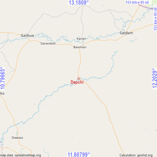
Dapchi GPS coordinates[2]
12° 29' 43.296" North, 11° 29' 59.172" East
| Map corner | latitude | longitude |
|---|---|---|
| Upper-left | 13.1809°, | 10.79665° |
| Center: | 12.49536°, | 11.49977° |
| Lower-right: | 11.80799°, | 12.2029° |
| Map W x H: | 152.7×152.7 km | = 94.9×94.9mi |
| max Lat: | 13.7543° ⇑9.4% North |
| Dapchi: | 12.49536° |
| min Lat: | ⇓90.6% South 4.31231° |
| min Long | Dapchi | max Long |
| 2.73333° | 11.49977° | 14.46552° |
| W 92.2%⇐ | ⇒7.8% E |
Elevation
Elevation of Dapchi is 341 m = 1119 ft, and this is 44.5 m = 146 ft above average elevation for this country.
| Max E: |
1599 m = 5246 ft | 40.6% |
| Dapchi | 341 m 1119 ft | |
| Avg. | 296.5 m = 973 ft | |
Min E: |
2 m = 7 ft | 59.4% |
See also: Nigeria elevation on elevation.city.
Geographical zone
Dapchi is located in North Torrid zone (between Equator and Tropic of Cancer). Distance of this Northern Tropic circle is 1216.6 km =756 mi to North.| Distance of | km | miles | from Dapchi |
|---|---|---|---|
| North Pole | 8617.7 | 5354.8 | to North |
| Arctic Circle | 6011.8 | 3735.6 | to North |
| Tropic Cancer | 1216.6 | 756 | to North |
| Equator | 1389.4 | 863.3 | to South |


Nearby cities:
15 places around Dapchi: (largest is in red/bold)
• Babban Gida
48 km =29.8 mi,  142°
142°
• Damagum
92.6 km =57.5 mi,  191°
191°
• Damaturu
97.1 km =60.3 mi,  148°
148°
• Dankalwa
111.9 km =69.5 mi, 138°
• Daura
105.2 km =65.4 mi, 185°
• Gashua
65.2 km =40.5 mi,  310°
310°
• Geidam
64.1 km =39.8 mi,  46°
46°
• Gorgoram
87.8 km =54.6 mi,  280°
280°
• Gwio Kura
51 km =31.7 mi,  293°
293°
• Jajimaji
87.5 km =54.4 mi,  300°
300°
• Jakusko
80 km =49.7 mi,  260°
260°
• Kanamma
94.1 km =58.5 mi,  44°
44°
• Lajere
57.6 km =35.8 mi, 186°
• Potiskum
98.1 km =61 mi,  207°
207°
• Sabon Garin Nangere
85.5 km =53.1 mi, 212°
Sources, notices
• [Note1] Compared only with cities in Nigeria existing in our database
• [Src1] Map data: © OpenStreetMap contributors (CC-BY-SA)
• [Src2] Other city data from geonames.org with taken over terms of usage.
• [Src3] Geographical zone / Annual Mean Temperature by Robert A. Rohde @ Wikipedia
