Geidam geodata
Geidam (Yobe) is a seat of a second-order administrative division; located in Nigeria in Africa/Lagos (GMT+1) time zone. With population of 41,367 people, there are 152 cities with bigger population in this country. Compared to other cities in Nigeria, 96.1% of cities are located further ↓South; 93.3% of cities are located further ←West and 57.5% of cities have lower elevation than Geidam. Note1


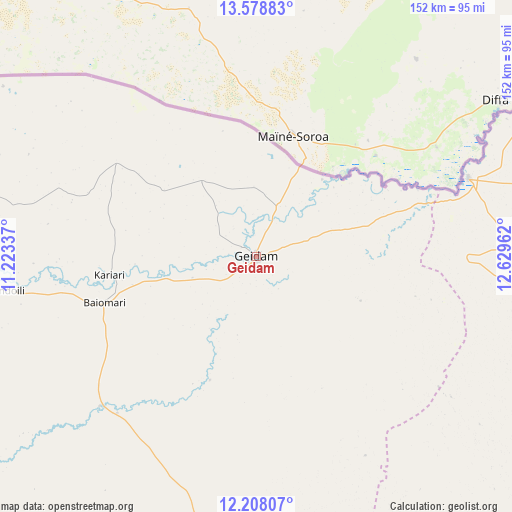
Geidam GPS coordinates[2]
12° 53' 39.804" North, 11° 55' 35.364" East
| Map corner | latitude | longitude |
|---|---|---|
| Upper-left | 13.57883°, | 11.22337° |
| Center: | 12.89439°, | 11.92649° |
| Lower-right: | 12.20807°, | 12.62962° |
| Map W x H: | 152.4×152.4 km | = 94.7×94.7mi |
| max Lat: | 13.7543° ⇑3.9% North |
| Geidam: | 12.89439° |
| min Lat: | ⇓96.1% South 4.31231° |
| min Long | Geidam | max Long |
| 2.73333° | 11.92649° | 14.46552° |
| W 93.3%⇐ | ⇒6.7% E |
Elevation
Elevation of Geidam is 329 m = 1079 ft, and this is 32.5 m = 107 ft above average elevation for this country.
| Max E: |
1599 m = 5246 ft | 42.5% |
| Geidam | 329 m 1079 ft | |
| Avg. | 296.5 m = 973 ft | |
Min E: |
2 m = 7 ft | 57.5% |
See also: Geidam elevation on elevation.city.
Geographical zone
Geidam is located in North Torrid zone (between Equator and Tropic of Cancer). Distance of this Northern Tropic circle is 1172.2 km =728.4 mi to North.| Distance of | km | miles | from Geidam |
|---|---|---|---|
| North Pole | 8573.3 | 5327.2 | to North |
| Arctic Circle | 5967.5 | 3708 | to North |
| Tropic Cancer | 1172.2 | 728.4 | to North |
| Equator | 1433.7 | 890.9 | to South |


Nearby cities:
15 places around Geidam: (largest is in red/bold)
• Babban Gida
83.9 km =52.1 mi,  191°
191°
• Benisheikh
135.4 km =84.1 mi,  153°
153°
• Bornu Yassu
98 km =60.9 mi,  134°
134°
• Damasak
67.3 km =41.8 mi,  69°
69°
• Damaturu
127.6 km =79.3 mi,  178°
178°
• Dankalwa
130.9 km =81.3 mi,  167°
167°
• Dapchi
64.1 km =39.8 mi,  226°
226°
• Gashua
96.1 km =59.7 mi,  268°
268°
• Gorgoram
135.5 km =84.2 mi,  257°
257°
• Gubio
102.6 km =63.8 mi,  115°
115°
• Gwio Kura
96.4 km =59.9 mi, 255°
• Jajimaji
121.3 km =75.4 mi, 270°
• Kanamma
30.1 km =18.7 mi,  40°
40°
• Lajere
114.6 km =71.2 mi,  207°
207°
• Magumeri
130.6 km =81.2 mi, 131°
Sources, notices
• [Note1] Compared only with cities in Nigeria existing in our database
• [Src1] Map data: © OpenStreetMap contributors (CC-BY-SA)
• [Src2] Other city data from geonames.org with taken over terms of usage.
• [Src3] Geographical zone / Annual Mean Temperature by Robert A. Rohde @ Wikipedia
