Omoba geodata
Omoba (Abia) is a seat of a second-order administrative division; located in Nigeria in Africa/Lagos (GMT+1) time zone. In our database, there are 451 cities with bigger population. Compared to other cities in Nigeria, 91.8% of cities are located further ↑North; 51.6% of cities are located further ←West and 77.2% of cities have higher elevation than Omoba. Note1


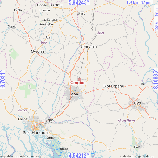
Omoba GPS coordinates[2]
5° 14' 33.648" North, 7° 24' 22.428" East
| Map corner | latitude | longitude |
|---|---|---|
| Upper-left | 5.94245°, | 6.7031° |
| Center: | 5.24268°, | 7.40623° |
| Lower-right: | 4.54212°, | 8.10935° |
| Map W x H: | 155.7×155.7 km | = 96.7×96.7mi |
| max Lat: | 13.7543° ⇑91.8% North |
| Omoba: | 5.24268° |
| min Lat: | ⇓8.2% South 4.31231° |
| min Long | Omoba | max Long |
| 2.73333° | 7.40623° | 14.46552° |
| W 51.6%⇐ | ⇒48.4% E |
Elevation
Elevation of Omoba is 98 m = 322 ft, and this is 198.5 m = 651 ft below average elevation for this country.
| Max E: |
1599 m = 5246 ft | 77.2% |
| Avg. | 296.5 m = 973 ft | |
| Omoba | 98 m = 322 ft | |
Min E: |
2 m = 7 ft | 22.8% |
See also: Nigeria elevation on elevation.city.
Geographical zone
Omoba is located in North Torrid zone (between Equator and Tropic of Cancer). Distance of Equator is 582.9 km =362.2 mi to South.| Distance of | km | miles | from Omoba |
|---|---|---|---|
| North Pole | 9424.1 | 5855.9 | to North |
| Arctic Circle | 6818.2 | 4236.6 | to North |
| Tropic Cancer | 2023 | 1257 | to North |
| Equator | 582.9 | 362.2 | to South |


Nearby cities:
15 places around Omoba: (largest is in red/bold)
• Aba
15.8 km =9.8 mi,  196°
196°
• Aboh
29.9 km =18.6 mi,  330°
330°
• Afaha Ikot Ebak
30.7 km =19.1 mi,  115°
115°
• Eberi
25.5 km =15.8 mi,  228°
228°
• Ibiaku Ntok Okpo
34.5 km =21.4 mi,  77°
77°
• Ikot Ekpene
34.8 km =21.6 mi,  101°
101°
• Isiala Oboro
25.5 km =15.8 mi,  44°
44°
• Itu
26 km =16.2 mi,  341°
341°
• Nto Edino
18.8 km =11.7 mi,  85°
85°
• Okehi
31.7 km =19.7 mi,  248°
248°
• Okpuala-Ngwa
12.9 km =8 mi,  350°
350°
• Osisioma
13.1 km =8.1 mi, 225°
• Umuahia
32.9 km =20.4 mi,  17°
17°
• Umuneke-Ngor
30 km =18.6 mi,  290°
290°
• Urua Inyang
28.5 km =17.7 mi,  148°
148°
Sources, notices
• [Note1] Compared only with cities in Nigeria existing in our database
• [Src1] Map data: © OpenStreetMap contributors (CC-BY-SA)
• [Src2] Other city data from geonames.org with taken over terms of usage.
• [Src3] Geographical zone / Annual Mean Temperature by Robert A. Rohde @ Wikipedia
