Ibiaku Ntok Okpo geodata
Ibiaku Ntok Okpo (Akwa Ibom) is a seat of a second-order administrative division; located in Nigeria in Africa/Lagos (GMT+1) time zone. In our database, there are 451 cities with bigger population. Compared to other cities in Nigeria, 91.6% of cities are located further ↑North; 58% of cities are located further ←West and 73.5% of cities have higher elevation than Ibiaku Ntok Okpo. Note1


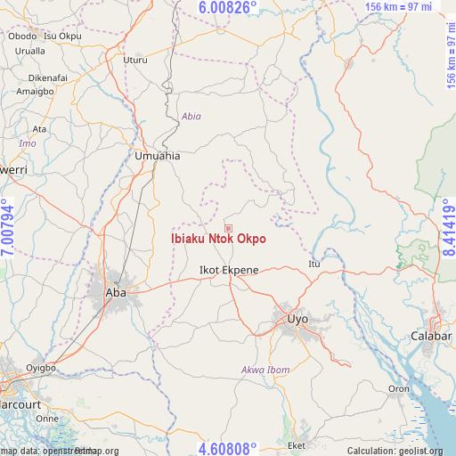
Ibiaku Ntok Okpo GPS coordinates[2]
5° 18' 30.852" North, 7° 42' 39.816" East
| Map corner | latitude | longitude |
|---|---|---|
| Upper-left | 6.00826°, | 7.00794° |
| Center: | 5.30857°, | 7.71106° |
| Lower-right: | 4.60808°, | 8.41419° |
| Map W x H: | 155.7×155.7 km | = 96.7×96.7mi |
| max Lat: | 13.7543° ⇑91.6% North |
| Ibiaku Ntok Okpo: | 5.30857° |
| min Lat: | ⇓8.4% South 4.31231° |
| min Long | Ibiaku Ntok Okp | max Long |
| 2.73333° | 7.71106° | 14.46552° |
| W 58%⇐ | ⇒42% E |
Elevation
Elevation of Ibiaku Ntok Okpo is 129 m = 423 ft, and this is 167.5 m = 550 ft below average elevation for this country.
| Max E: |
1599 m = 5246 ft | 73.5% |
| Avg. | 296.5 m = 973 ft | |
| Ibiaku Ntok Okpo | 129 m = 423 ft | |
Min E: |
2 m = 7 ft | 26.5% |
See also: Nigeria elevation on elevation.city.
Geographical zone
Ibiaku Ntok Okpo is located in North Torrid zone (between Equator and Tropic of Cancer). Distance of Equator is 590.3 km =366.8 mi to South.| Distance of | km | miles | from Ibiaku Ntok Okpo |
|---|---|---|---|
| North Pole | 9416.8 | 5851.3 | to North |
| Arctic Circle | 6810.9 | 4232.1 | to North |
| Tropic Cancer | 2015.7 | 1252.5 | to North |
| Equator | 590.3 | 366.8 | to South |


Nearby cities:
15 places around Ibiaku Ntok Okpo: (largest is in red/bold)
• Afaha Ikot Ebak
21.3 km =13.2 mi,  196°
196°
• Arochukwu
24 km =14.9 mi,  68°
68°
• Bende
29.1 km =18.1 mi,  342°
342°
• Ikot Ekpene
14.1 km =8.8 mi,  178°
178°
• Isiala Oboro
19.2 km =11.9 mi,  304°
304°
• Itu
32.5 km =20.2 mi,  111°
111°
• Nto Edino
16 km =9.9 mi,  249°
249°
• Odoro Ikpe
7.1 km =4.4 mi,  39°
39°
• Ohafia-Ifigh
35.8 km =22.2 mi,  18°
18°
• Oko Ita
24.2 km =15 mi,  122°
122°
• Okpuala-Ngwa
36.2 km =22.5 mi,  278°
278°
• Omoba
34.5 km =21.4 mi,  257°
257°
• Umuahia
34 km =21.1 mi,  315°
315°
• Urua Inyang
37 km =23 mi,  210°
210°
• Utu Etim Ekpo
35.6 km =22.1 mi, 198°
Sources, notices
• [Note1] Compared only with cities in Nigeria existing in our database
• [Src1] Map data: © OpenStreetMap contributors (CC-BY-SA)
• [Src2] Other city data from geonames.org with taken over terms of usage.
• [Src3] Geographical zone / Annual Mean Temperature by Robert A. Rohde @ Wikipedia
