Segalstad geodata
Segalstad (Oppland) is a populated place; located in Norway in Europe/Oslo (GMT+2) time zone. With population of 864 people, there are 343 cities with bigger population in this country. Compared to other cities in Norway, 58.7% of cities are located further ↓South; 51.9% of cities are located further ←West and 93.7% of cities have lower elevation than Segalstad. Note1


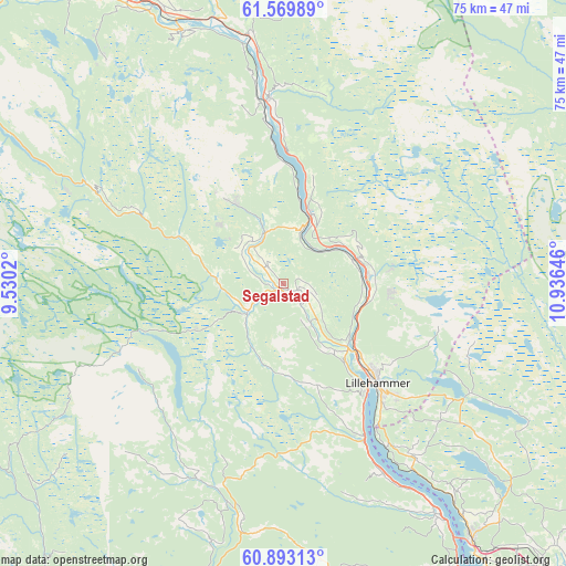
Segalstad GPS coordinates[2]
61° 13' 59.988" North, 10° 13' 59.988" East
| Map corner | latitude | longitude |
|---|---|---|
| Upper-left | 61.56989°, | 9.5302° |
| Center: | 61.23333°, | 10.23333° |
| Lower-right: | 60.89313°, | 10.93646° |
| Map W x H: | 75.2×75.2 km | = 46.7×46.7mi |
| max Lat: | 71.04137° ⇑41.3% North |
| Segalstad: | 61.23333° |
| min Lat: | ⇓58.7% South 58.0274° |
| min Long | Segalstad | max Long |
| 4.71485° | 10.23333° | 31.11066° |
| W 51.9%⇐ | ⇒48.1% E |
Elevation
Elevation of Segalstad is 400 m = 1312 ft, and this is 295.8 m = 970 ft above average elevation for this country.
| Max E: |
897 m = 2943 ft | 6.3% |
| Segalstad | 400 m 1312 ft | |
| Avg. | 104.2 m = 342 ft | |
Min E: |
1 m = 3 ft | 93.7% |
See also: Norway elevation on elevation.city.
Geographical zone
Segalstad is located in North temperate zone (between Tropic of Cancer and the Arctic Circle). Distance of this North polar circle is 592.7 km =368.3 mi to North.| Distance of | km | miles | from Segalstad |
|---|---|---|---|
| North Pole | 3198.6 | 1987.5 | to North |
| Arctic Circle | 592.7 | 368.3 | to North |
| Tropic Cancer | 4202.6 | 2611.4 | to South |
| Equator | 6808.5 | 4230.6 | to South |


Nearby cities:
15 places around Segalstad: (largest is in red/bold)
• Aurdal
55.8 km =34.7 mi,  232°
232°
• Bruflat
49.9 km =31 mi,  219°
219°
• Brumunddal
54.6 km =33.9 mi,  135°
135°
• Dokka
45.1 km =28 mi,  190°
190°
• Follebu
3.4 km =2.1 mi,  125°
125°
• Forset
5.9 km =3.7 mi, 234°
• Gjøvik
54.6 km =33.9 mi,  153°
153°
• Hundorp
39 km =24.2 mi,  336°
336°
• Kvam
56.1 km =34.9 mi,  328°
328°
• Lillehammer
18.1 km =11.2 mi, 136°
• Moelv
41.7 km =25.9 mi, 143°
• Ringebu
33.3 km =20.7 mi,  351°
351°
• Segalstad bru
0.8 km =0.5 mi, 225°
• Tretten
9.7 km =6 mi,  21°
21°
• Vinstra
47.7 km =29.6 mi, 327°
Sources, notices
• [Note1] Compared only with cities in Norway existing in our database
• [Src1] Map data: © OpenStreetMap contributors (CC-BY-SA)
• [Src2] Other city data from geonames.org with taken over terms of usage.
• [Src3] Geographical zone / Annual Mean Temperature by Robert A. Rohde @ Wikipedia
