Bruflat geodata
Bruflat (Oppland) is a seat of a second-order administrative division; located in Norway in Europe/Oslo (GMT+2) time zone. In our database, there are 488 cities with bigger population. Compared to other cities in Norway, 54.6% of cities are located further ↓South; 54.9% of cities are located further →East and 92.4% of cities have lower elevation than Bruflat. Note1


Bruflat GPS coordinates[2]
60° 53' 16.116" North, 9° 38' 29.148" East
| Map corner | latitude | longitude |
|---|---|---|
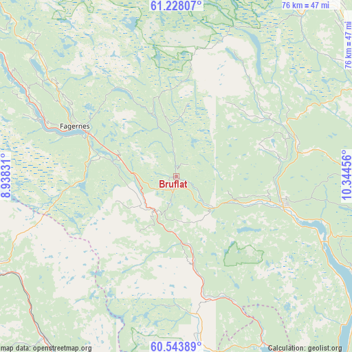
| Upper-left | 61.22807°, | 8.93831° |
| Center: | 60.88781°, | 9.64143° |
| Lower-right: | 60.54389°, | 10.34456° |
| Map W x H: | 76.1×76.1 km | = 47.3×47.3mi |
| max Lat: | 71.04137° ⇑45.4% North |
| Bruflat: | 60.88781° |
| min Lat: | ⇓54.6% South 58.0274° |
| min Long | Bruflat | max Long |
| 4.71485° | 9.64143° | 31.11066° |
| W 45.1%⇐ | ⇒54.9% E |
Elevation
Elevation of Bruflat is 331 m = 1086 ft, and this is 226.8 m = 744 ft above average elevation for this country.
| Max E: |
897 m = 2943 ft | 7.6% |
| Bruflat | 331 m 1086 ft | |
| Avg. | 104.2 m = 342 ft | |
Min E: |
1 m = 3 ft | 92.4% |
See also: Norway elevation on elevation.city.
Geographical zone
Bruflat is located in North temperate zone (between Tropic of Cancer and the Arctic Circle). Distance of this North polar circle is 631.1 km =392.1 mi to North.| Distance of | km | miles | from Bruflat |
|---|---|---|---|
| North Pole | 3237 | 2011.4 | to North |
| Arctic Circle | 631.1 | 392.1 | to North |
| Tropic Cancer | 4164.2 | 2587.5 | to South |
| Equator | 6770.1 | 4206.7 | to South |


Nearby cities:
15 places around Bruflat: (largest is in red/bold)
• Aurdal
12.9 km =8 mi,  288°
288°
• Bagn
8.7 km =5.4 mi,  213°
213°
• Dokka
24.1 km =15 mi,  104°
104°
• Fagernes
24.6 km =15.3 mi,  296°
296°
• Follebu
50.3 km =31.3 mi,  43°
43°
• Forset
44.2 km =27.5 mi, 37°
• Gol
43.1 km =26.8 mi,  241°
241°
• Heggenes
42 km =26.1 mi,  312°
312°
• Hov
43.9 km =27.3 mi,  118°
118°
• Leira
20.8 km =12.9 mi, 296°
• Lillehammer
51.1 km =31.8 mi,  60°
60°
• Nesbyen
46.1 km =28.6 mi,  219°
219°
• Segalstad
49.9 km =31 mi, 39°
• Segalstad bru
49.1 km =30.5 mi, 39°
• Slidre
42 km =26.1 mi, 302°
Sources, notices
• [Note1] Compared only with cities in Norway existing in our database
• [Src1] Map data: © OpenStreetMap contributors (CC-BY-SA)
• [Src2] Other city data from geonames.org with taken over terms of usage.
• [Src3] Geographical zone / Annual Mean Temperature by Robert A. Rohde @ Wikipedia
