Sunndalsøra geodata
Sunndalsøra (Møre og Romsdal) is a seat of a second-order administrative division; located in Norway in Europe/Oslo (GMT+2) time zone. With population of 4,159 people, there are 106 cities with bigger population in this country. Compared to other cities in Norway, 70.4% of cities are located further ↓South; 63.3% of cities are located further →East and 92.6% of cities have lower elevation than Sunndalsøra. Note1


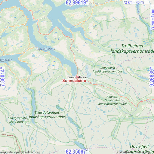
Sunndalsøra GPS coordinates[2]
62° 40' 30.684" North, 8° 33' 47.772" East
| Map corner | latitude | longitude |
|---|---|---|
| Upper-left | 62.99619°, | 7.86014° |
| Center: | 62.67519°, | 8.56327° |
| Lower-right: | 62.35067°, | 9.26639° |
| Map W x H: | 71.8×71.8 km | = 44.6×44.6mi |
| max Lat: | 71.04137° ⇑29.6% North |
| Sunndalsøra: | 62.67519° |
| min Lat: | ⇓70.4% South 58.0274° |
| min Long | Sunndalsøra | max Long |
| 4.71485° | 8.56327° | 31.11066° |
| W 36.7%⇐ | ⇒63.3% E |
Elevation
Elevation of Sunndalsøra is 346 m = 1135 ft, and this is 241.8 m = 793 ft above average elevation for this country.
| Max E: |
897 m = 2943 ft | 7.4% |
| Sunndalsøra | 346 m 1135 ft | |
| Avg. | 104.2 m = 342 ft | |
Min E: |
1 m = 3 ft | 92.6% |
See also: Norway elevation on elevation.city.
Geographical zone
Sunndalsøra is located in North temperate zone (between Tropic of Cancer and the Arctic Circle). Distance of this North polar circle is 432.3 km =268.6 mi to North.| Distance of | km | miles | from Sunndalsøra |
|---|---|---|---|
| North Pole | 3038.2 | 1887.8 | to North |
| Arctic Circle | 432.3 | 268.6 | to North |
| Tropic Cancer | 4362.9 | 2711 | to South |
| Equator | 6968.8 | 4330.2 | to South |


Nearby cities:
15 places around Sunndalsøra: (largest is in red/bold)
• Batnfjordsøra
51.4 km =31.9 mi,  298°
298°
• Bruhagen
63.1 km =39.2 mi,  311°
311°
• Eide
62.8 km =39 mi, 295°
• Eidsvåg
27.8 km =17.3 mi,  293°
293°
• Grøa
8.9 km =5.5 mi,  112°
112°
• Hjelset
55.8 km =34.7 mi,  282°
282°
• Kristiansund
64.3 km =40 mi,  318°
318°
• Lesja
63.8 km =39.6 mi,  165°
165°
• Liabøen
51.3 km =31.9 mi,  345°
345°
• Oppdal
58.3 km =36.2 mi,  98°
98°
• Rensvik
60.3 km =37.5 mi, 321°
• Rindal
53.6 km =33.3 mi,  37°
37°
• Surnadal
34.2 km =21.3 mi,  13°
13°
• Tingvoll
32.1 km =19.9 mi,  325°
325°
• Åndalsnes
46.4 km =28.8 mi,  255°
255°
Sources, notices
• [Note1] Compared only with cities in Norway existing in our database
• [Src1] Map data: © OpenStreetMap contributors (CC-BY-SA)
• [Src2] Other city data from geonames.org with taken over terms of usage.
• [Src3] Geographical zone / Annual Mean Temperature by Robert A. Rohde @ Wikipedia
