Grøa geodata
Grøa (Møre og Romsdal) is a populated place; located in Norway in Europe/Oslo (GMT+2) time zone. With population of 502 people, there are 460 cities with bigger population in this country. Compared to other cities in Norway, 70.1% of cities are located further ↓South; 61.7% of cities are located further →East and 60% of cities have lower elevation than Grøa. Note1


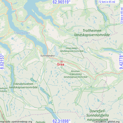
Grøa GPS coordinates[2]
62° 38' 37.86" North, 8° 43' 28.74" East
| Map corner | latitude | longitude |
|---|---|---|
| Upper-left | 62.96519°, | 8.02153° |
| Center: | 62.64385°, | 8.72465° |
| Lower-right: | 62.31898°, | 9.42778° |
| Map W x H: | 71.9×71.8 km | = 44.7×44.6mi |
| max Lat: | 71.04137° ⇑29.9% North |
| Grøa: | 62.64385° |
| min Lat: | ⇓70.1% South 58.0274° |
| min Long | Grøa | max Long |
| 4.71485° | 8.72465° | 31.11066° |
| W 38.3%⇐ | ⇒61.7% E |
Elevation
Elevation of Grøa is 66 m = 217 ft, and this is 38.2 m = 125 ft below average elevation for this country.
| Max E: |
897 m = 2943 ft | 40% |
| Avg. | 104.2 m = 342 ft | |
| Grøa | 66 m = 217 ft | |
Min E: |
1 m = 3 ft | 60% |
See also: Norway elevation on elevation.city.
Geographical zone
Grøa is located in North temperate zone (between Tropic of Cancer and the Arctic Circle). Distance of this North polar circle is 435.8 km =270.8 mi to North.| Distance of | km | miles | from Grøa |
|---|---|---|---|
| North Pole | 3041.7 | 1890 | to North |
| Arctic Circle | 435.8 | 270.8 | to North |
| Tropic Cancer | 4359.4 | 2708.8 | to South |
| Equator | 6965.3 | 4328 | to South |


Nearby cities:
15 places around Grøa: (largest is in red/bold)
• Batnfjordsøra
60.4 km =37.5 mi,  297°
297°
• Berkåk
68.6 km =42.6 mi,  72°
72°
• Dombås
66.5 km =41.3 mi,  161°
161°
• Eidsvåg
36.7 km =22.8 mi,  293°
293°
• Hjelset
64.6 km =40.1 mi,  283°
283°
• Lesja
58.9 km =36.6 mi,  172°
172°
• Liabøen
57.1 km =35.5 mi,  338°
338°
• Meldal
67.3 km =41.8 mi,  48°
48°
• Oppdal
49.7 km =30.9 mi,  96°
96°
• Rensvik
68.2 km =42.4 mi,  317°
317°
• Rindal
52 km =32.3 mi,  28°
28°
• Sunndalsøra
8.9 km =5.5 mi, 292°
• Surnadal
36.7 km =22.8 mi,  0°
0°
• Tingvoll
39.9 km =24.8 mi, 318°
• Åndalsnes
53.8 km =33.4 mi,  260°
260°
Sources, notices
• [Note1] Compared only with cities in Norway existing in our database
• [Src1] Map data: © OpenStreetMap contributors (CC-BY-SA)
• [Src2] Other city data from geonames.org with taken over terms of usage.
• [Src3] Geographical zone / Annual Mean Temperature by Robert A. Rohde @ Wikipedia
