Sur geodata
Sur (Southeastern Governorate) is a seat of a first-order administrative division; located in Oman in Asia/Muscat (GMT+4) time zone. With population of 71,152 people, there are 12 cities with bigger population in this country. Compared to other cities in Oman, 83.9% of cities are located further ↑North; 100% of cities are located further ←West and 83.9% of cities have higher elevation than Sur. Note1


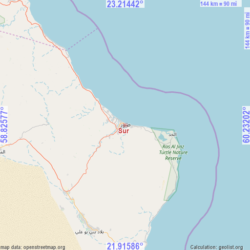
Sur GPS coordinates[2]
22° 34' 0.012" North, 59° 31' 44.004" East
| Map corner | latitude | longitude |
|---|---|---|
| Upper-left | 23.21442°, | 58.82577° |
| Center: | 22.56667°, | 59.52889° |
| Lower-right: | 21.91586°, | 60.23202° |
| Map W x H: | 144.4×144.4 km | = 89.7×89.7mi |
| max Lat: | 26.19778° ⇑83.9% North |
| Sur: | 22.56667° |
| min Lat: | ⇓16.1% South 17.01505° |
| min Long | Sur | max Long |
| 52.66042° | 59.52889° | 59.52889° |
| W 100%⇐ | ⇒0% E |
Elevation
Elevation of Sur is 6 m = 20 ft, and this is 200.7 m = 658 ft below average elevation for this country.
| Max E: |
684 m = 2244 ft | 83.9% |
| Avg. | 206.7 m = 678 ft | |
| Sur | 6 m = 20 ft | |
Min E: |
1 m = 3 ft | 16.1% |
See also: Sur elevation on elevation.city.
Geographical zone
Sur is located in North Torrid zone (between Equator and Tropic of Cancer). Distance of this Northern Tropic circle is 96.7 km =60.1 mi to North.| Distance of | km | miles | from Sur |
|---|---|---|---|
| North Pole | 7497.9 | 4659 | to North |
| Arctic Circle | 4892 | 3039.7 | to North |
| Tropic Cancer | 96.7 | 60.1 | to North |
| Equator | 2509.2 | 1559.1 | to South |


Nearby cities:
15 places around Sur: (largest is in red/bold)
• Adam
206.7 km =128.4 mi,  264°
264°
• Al Qābil
85.6 km =53.2 mi,  270°
270°
• Badīyah
76 km =47.2 mi, 260°
• Bahlā’
232.6 km =144.5 mi,  281°
281°
• Barkā’
208.6 km =129.6 mi,  306°
306°
• Bawshar
161.2 km =100.2 mi, 314°
• Bayt al ‘Awābī
221 km =137.3 mi,  291°
291°
• Bidbid
171.2 km =106.4 mi,  303°
303°
• Ibrā’
103.1 km =64.1 mi, 277°
• Izkī
185.2 km =115.1 mi, 282°
• Muscat
161.1 km =100.1 mi, 314°
• Nizwá
208.6 km =129.6 mi, 281°
• Oman Smart Future City
231.3 km =143.7 mi, 301°
• Seeb
183.9 km =114.3 mi, 311°
• Sufālat Samā’il
175.9 km =109.3 mi, 298°
Sources, notices
• [Note1] Compared only with cities in Oman existing in our database
• [Src1] Map data: © OpenStreetMap contributors (CC-BY-SA)
• [Src2] Other city data from geonames.org with taken over terms of usage.
• [Src3] Geographical zone / Annual Mean Temperature by Robert A. Rohde @ Wikipedia
