Al Buraymī geodata
Al Buraymī (Al Buraimi) is a seat of a first-order administrative division; located in Oman in Asia/Muscat (GMT+4) time zone. With population of 73,670 people, there are 10 cities with bigger population in this country. Compared to other cities in Oman, 80.6% of cities are located further ↓South; 93.5% of cities are located further →East and 61.3% of cities have lower elevation than Al Buraymī. Note1


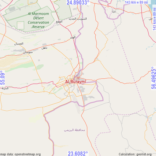
Al Buraymī GPS coordinates[2]
24° 15' 3.168" North, 55° 47' 35.232" East
| Map corner | latitude | longitude |
|---|---|---|
| Upper-left | 24.89033°, | 55.09° |
| Center: | 24.25088°, | 55.79312° |
| Lower-right: | 23.6082°, | 56.49625° |
| Map W x H: | 142.6×142.6 km | = 88.6×88.6mi |
| max Lat: | 26.19778° ⇑19.4% North |
| Al Buraymī: | 24.25088° |
| min Lat: | ⇓80.6% South 17.01505° |
| min Long | Al Buraymī | max Long |
| 52.66042° | 55.79312° | 59.52889° |
| W 6.5%⇐ | ⇒93.5% E |
Elevation
Elevation of Al Buraymī is 297 m = 974 ft, and this is 90.3 m = 296 ft above average elevation for this country.
| Max E: |
684 m = 2244 ft | 38.7% |
| Al Buraymī | 297 m 974 ft | |
| Avg. | 206.7 m = 678 ft | |
Min E: |
1 m = 3 ft | 61.3% |
See also: Al Buraymī elevation on elevation.city.
Geographical zone
Al Buraymī is located in North temperate zone (between Tropic of Cancer and the Arctic Circle). Distance of this Northern Tropic circle is 90.5 km =56.2 mi to South.| Distance of | km | miles | from Al Buraymī |
|---|---|---|---|
| North Pole | 7310.6 | 4542.6 | to North |
| Arctic Circle | 4704.7 | 2923.4 | to North |
| Tropic Cancer | 90.5 | 56.2 | to South |
| Equator | 2696.4 | 1675.5 | to South |


Nearby cities:
15 places around Al Buraymī: (largest is in red/bold)
• Al Khābūrah
135.5 km =84.2 mi,  103°
103°
• As Suwayq
172.9 km =107.4 mi, 104°
• Bahlā’
209.1 km =129.9 mi,  132°
132°
• Bayt al ‘Awābī
205.3 km =127.6 mi,  120°
120°
• Dib Dibba
221.5 km =137.6 mi,  12°
12°
• Khasab
219.3 km =136.3 mi, 12°
• Liwá
83.9 km =52.1 mi,  68°
68°
• Madḩā’ al Jadīdah
127.1 km =79 mi,  25°
25°
• Oman Smart Future City
195.2 km =121.3 mi,  109°
109°
• Rustaq
191.5 km =119 mi, 119°
• Shināş
87.4 km =54.3 mi,  51°
51°
• Sohar
93.5 km =58.1 mi,  83°
83°
• Yanqul
105.9 km =65.8 mi, 134°
• Şaḩam
111.4 km =69.2 mi,  94°
94°
• ‘Ibrī
135.7 km =84.3 mi,  147°
147°
Sources, notices
• [Note1] Compared only with cities in Oman existing in our database
• [Src1] Map data: © OpenStreetMap contributors (CC-BY-SA)
• [Src2] Other city data from geonames.org with taken over terms of usage.
• [Src3] Geographical zone / Annual Mean Temperature by Robert A. Rohde @ Wikipedia
