Villa Darién geodata
Villa Darién (Darién) is a populated place; located in Panama in America/Panama (GMT-5) time zone. With population of 502 people, there are 486 cities with bigger population in this country. Compared to other cities in Panama, 58.7% of cities are located further ↓South; 97.1% of cities are located further ←West and 55% of cities have higher elevation than Villa Darién. Note1


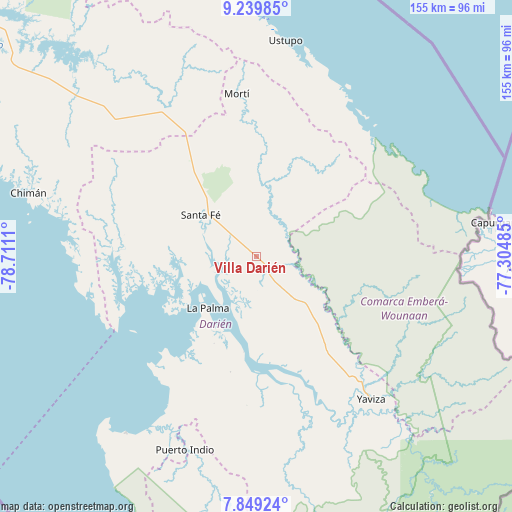
Villa Darién GPS coordinates[2]
8° 32' 42.648" North, 78° 0' 28.692" West
| Map corner | latitude | longitude |
|---|---|---|
| Upper-left | 9.23985°, | -78.7111° |
| Center: | 8.54518°, | -78.00797° |
| Lower-right: | 7.84924°, | -77.30485° |
| Map W x H: | 154.6×154.6 km | = 96.1×96.1mi |
| max Lat: | 9.60898° ⇑41.3% North |
| Villa Darién: | 8.54518° |
| min Lat: | ⇓58.7% South 7.26534° |
| min Long | Villa Darién | max Long |
| -82.91275° | -78.00797° | -77.38965° |
| W 97.1%⇐ | ⇒2.9% E |
Elevation
Elevation of Villa Darién is 63 m = 207 ft, and this is 109.1 m = 358 ft below average elevation for this country.
| Max E: |
2103 m = 6900 ft | 55% |
| Avg. | 172.1 m = 565 ft | |
| Villa Darién | 63 m = 207 ft | |
Min E: |
-1 m = -3 ft | 45% |
See also: Panama elevation on elevation.city.
Geographical zone
Villa Darién is located in North Torrid zone (between Equator and Tropic of Cancer). Distance of Equator is 950.1 km =590.4 mi to South.| Distance of | km | miles | from Villa Darién |
|---|---|---|---|
| North Pole | 9056.9 | 5627.7 | to North |
| Arctic Circle | 6451 | 4008.5 | to North |
| Tropic Cancer | 1655.8 | 1028.9 | to North |
| Equator | 950.1 | 590.4 | to South |


Nearby cities:
15 places around Villa Darién: (largest is in red/bold)
• Agua Fría Número Uno
40.6 km =25.2 mi,  329°
329°
• Barriales
42 km =26.1 mi,  275°
275°
• Cañazas
46 km =28.6 mi, 328°
• Chepigana
29.2 km =18.1 mi,  189°
189°
• Cucunatí
27.6 km =17.1 mi, 276°
• La Palma
21.2 km =13.2 mi,  223°
223°
• Lajas Blancas
26 km =16.2 mi,  123°
123°
• Metetí
6 km =3.7 mi,  148°
148°
• Mortí
33.2 km =20.6 mi,  6°
6°
• Mortí
35.6 km =22.1 mi,  16°
16°
• Punta Alegre
38.8 km =24.1 mi, 224°
• Quebrada Honda
15.3 km =9.5 mi,  310°
310°
• Santa Fé
20.8 km =12.9 mi, 305°
• Setegantí
29.7 km =18.5 mi,  199°
199°
• Zapallal
17.7 km =11 mi, 310°
Sources, notices
• [Note1] Compared only with cities in Panama existing in our database
• [Src1] Map data: © OpenStreetMap contributors (CC-BY-SA)
• [Src2] Other city data from geonames.org with taken over terms of usage.
• [Src3] Geographical zone / Annual Mean Temperature by Robert A. Rohde @ Wikipedia
