Quebrada Honda geodata
Quebrada Honda (Darién) is a populated place; located in Panama in America/Panama (GMT-5) time zone. With population of 501 people, there are 488 cities with bigger population in this country. Compared to other cities in Panama, 66.5% of cities are located further ↓South; 96.3% of cities are located further ←West and 73.6% of cities have higher elevation than Quebrada Honda. Note1


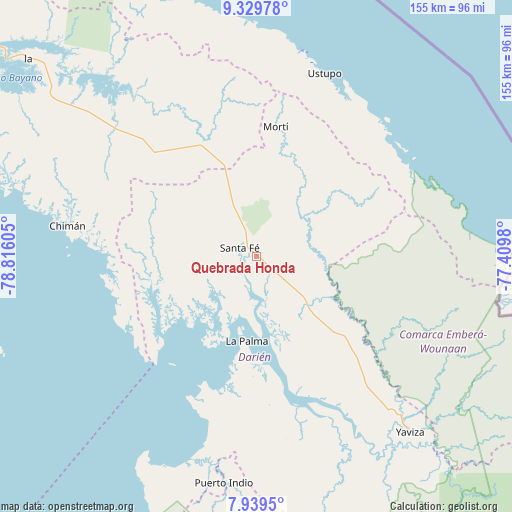
Quebrada Honda GPS coordinates[2]
8° 38' 7.008" North, 78° 6' 46.512" West
| Map corner | latitude | longitude |
|---|---|---|
| Upper-left | 9.32978°, | -78.81605° |
| Center: | 8.63528°, | -78.11292° |
| Lower-right: | 7.9395°, | -77.4098° |
| Map W x H: | 154.6×154.6 km | = 96.1×96.1mi |
| max Lat: | 9.60898° ⇑33.5% North |
| Quebrada Honda: | 8.63528° |
| min Lat: | ⇓66.5% South 7.26534° |
| min Long | Quebrada Honda | max Long |
| -82.91275° | -78.11292° | -77.38965° |
| W 96.3%⇐ | ⇒3.7% E |
Elevation
Elevation of Quebrada Honda is 32 m = 105 ft, and this is 140.1 m = 460 ft below average elevation for this country.
| Max E: |
2103 m = 6900 ft | 73.6% |
| Avg. | 172.1 m = 565 ft | |
| Quebrada Honda | 32 m = 105 ft | |
Min E: |
-1 m = -3 ft | 26.4% |
See also: Panama elevation on elevation.city.
Geographical zone
Quebrada Honda is located in North Torrid zone (between Equator and Tropic of Cancer). Distance of Equator is 960.2 km =596.6 mi to South.| Distance of | km | miles | from Quebrada Honda |
|---|---|---|---|
| North Pole | 9046.9 | 5621.5 | to North |
| Arctic Circle | 6441 | 4002.3 | to North |
| Tropic Cancer | 1645.8 | 1022.7 | to North |
| Equator | 960.2 | 596.6 | to South |


Nearby cities:
15 places around Quebrada Honda: (largest is in red/bold)
• Agua Fría Número Uno
26.5 km =16.5 mi,  339°
339°
• Barriales
30.8 km =19.1 mi,  259°
259°
• Cañazas
31.8 km =19.8 mi, 337°
• Chepigana
39.4 km =24.5 mi,  170°
170°
• Cucunatí
17.2 km =10.7 mi,  247°
247°
• La Palma
25.7 km =16 mi,  186°
186°
• Metetí
21.1 km =13.1 mi,  135°
135°
• Mortí
27.6 km =17.1 mi,  33°
33°
• Mortí
32.4 km =20.1 mi,  41°
41°
• Platanilla
36.7 km =22.8 mi,  305°
305°
• Santa Fé
5.8 km =3.6 mi,  292°
292°
• Setegantí
38 km =23.6 mi,  177°
177°
• Ualá
39.4 km =24.5 mi,  8°
8°
• Villa Darién
15.3 km =9.5 mi,  130°
130°
• Zapallal
2.5 km =1.6 mi, 309°
Sources, notices
• [Note1] Compared only with cities in Panama existing in our database
• [Src1] Map data: © OpenStreetMap contributors (CC-BY-SA)
• [Src2] Other city data from geonames.org with taken over terms of usage.
• [Src3] Geographical zone / Annual Mean Temperature by Robert A. Rohde @ Wikipedia
