Zapallal geodata
Zapallal (Darién) is a populated place; located in Panama in America/Panama (GMT-5) time zone. With population of 813 people, there are 317 cities with bigger population in this country. Compared to other cities in Panama, 67.6% of cities are located further ↓South; 96.2% of cities are located further ←West and 79.6% of cities have higher elevation than Zapallal. Note1


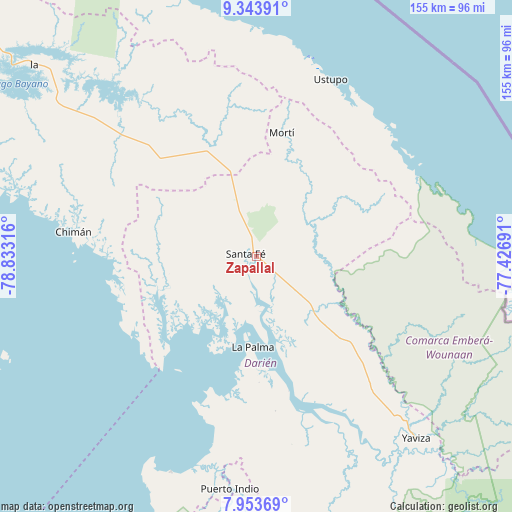
Zapallal GPS coordinates[2]
8° 38' 57.984" North, 78° 7' 48.108" West
| Map corner | latitude | longitude |
|---|---|---|
| Upper-left | 9.34391°, | -78.83316° |
| Center: | 8.64944°, | -78.13003° |
| Lower-right: | 7.95369°, | -77.42691° |
| Map W x H: | 154.6×154.6 km | = 96.1×96.1mi |
| max Lat: | 9.60898° ⇑32.4% North |
| Zapallal: | 8.64944° |
| min Lat: | ⇓67.6% South 7.26534° |
| min Long | Zapallal | max Long |
| -82.91275° | -78.13003° | -77.38965° |
| W 96.2%⇐ | ⇒3.8% E |
Elevation
Elevation of Zapallal is 24 m = 79 ft, and this is 148.1 m = 486 ft below average elevation for this country.
| Max E: |
2103 m = 6900 ft | 79.6% |
| Avg. | 172.1 m = 565 ft | |
| Zapallal | 24 m = 79 ft | |
Min E: |
-1 m = -3 ft | 20.4% |
See also: Panama elevation on elevation.city.
Geographical zone
Zapallal is located in North Torrid zone (between Equator and Tropic of Cancer). Distance of Equator is 961.7 km =597.6 mi to South.| Distance of | km | miles | from Zapallal |
|---|---|---|---|
| North Pole | 9045.3 | 5620.5 | to North |
| Arctic Circle | 6439.4 | 4001.3 | to North |
| Tropic Cancer | 1644.2 | 1021.7 | to North |
| Equator | 961.7 | 597.6 | to South |


Nearby cities:
15 places around Zapallal: (largest is in red/bold)
• Agua Fría Número Uno
24.4 km =15.2 mi,  342°
342°
• Barriales
29.3 km =18.2 mi,  255°
255°
• Cañazas
29.6 km =18.4 mi, 339°
• Chepigana
41.3 km =25.7 mi,  167°
167°
• Cucunatí
16.2 km =10.1 mi,  239°
239°
• La Palma
27.1 km =16.8 mi,  182°
182°
• Metetí
23.6 km =14.7 mi,  135°
135°
• Mortí
27.4 km =17 mi,  38°
38°
• Mortí
32.5 km =20.2 mi,  46°
46°
• Platanilla
34.3 km =21.3 mi,  305°
305°
• Quebrada Honda
2.5 km =1.6 mi,  129°
129°
• Santa Fé
3.5 km =2.2 mi,  280°
280°
• Setegantí
39.7 km =24.7 mi, 175°
• Ualá
38.2 km =23.7 mi,  11°
11°
• Villa Darién
17.7 km =11 mi, 130°
Sources, notices
• [Note1] Compared only with cities in Panama existing in our database
• [Src1] Map data: © OpenStreetMap contributors (CC-BY-SA)
• [Src2] Other city data from geonames.org with taken over terms of usage.
• [Src3] Geographical zone / Annual Mean Temperature by Robert A. Rohde @ Wikipedia
