Cañazas geodata
Cañazas (Panamá) is a populated place; located in Panama in America/Panama (GMT-5) time zone. With population of 653 people, there are 379 cities with bigger population in this country. Compared to other cities in Panama, 79.2% of cities are located further ↓South; 95% of cities are located further ←West and 62.2% of cities have lower elevation than Cañazas. Note1


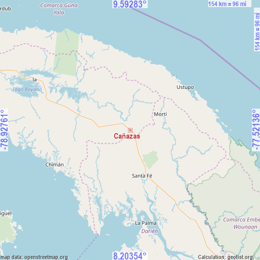
Cañazas GPS coordinates[2]
8° 53' 55.824" North, 78° 13' 28.128" West
| Map corner | latitude | longitude |
|---|---|---|
| Upper-left | 9.59283°, | -78.92761° |
| Center: | 8.89884°, | -78.22448° |
| Lower-right: | 8.20354°, | -77.52136° |
| Map W x H: | 154.5×154.5 km | = 96×96mi |
| max Lat: | 9.60898° ⇑20.8% North |
| Cañazas: | 8.89884° |
| min Lat: | ⇓79.2% South 7.26534° |
| min Long | Cañazas | max Long |
| -82.91275° | -78.22448° | -77.38965° |
| W 95%⇐ | ⇒5% E |
Elevation
Elevation of Cañazas is 115 m = 377 ft, and this is 57.1 m = 187 ft below average elevation for this country.
| Max E: |
2103 m = 6900 ft | 37.8% |
| Avg. | 172.1 m = 565 ft | |
| Cañazas | 115 m = 377 ft | |
Min E: |
-1 m = -3 ft | 62.2% |
See also: Panama elevation on elevation.city.
Geographical zone
Cañazas is located in North Torrid zone (between Equator and Tropic of Cancer). Distance of Equator is 989.5 km =614.8 mi to South.| Distance of | km | miles | from Cañazas |
|---|---|---|---|
| North Pole | 9017.6 | 5603.3 | to North |
| Arctic Circle | 6411.7 | 3984 | to North |
| Tropic Cancer | 1616.5 | 1004.4 | to North |
| Equator | 989.5 | 614.8 | to South |


Nearby cities:
15 places around Cañazas: (largest is in red/bold)
• Achutupo
42.3 km =26.3 mi,  38°
38°
• Agua Fría Número Uno
5.4 km =3.4 mi,  146°
146°
• Ailigandí
42.5 km =26.4 mi,  30°
30°
• Barriales
39.4 km =24.5 mi,  207°
207°
• Cucunatí
36.2 km =22.5 mi,  185°
185°
• Ipetí
31.8 km =19.8 mi,  284°
284°
• Mortí
28.1 km =17.5 mi,  102°
102°
• Mortí
34.2 km =21.3 mi, 98°
• Platanilla
19.2 km =11.9 mi,  245°
245°
• Quebrada Honda
31.8 km =19.8 mi,  157°
157°
• Santa Fé
28 km =17.4 mi,  165°
165°
• Tortí
20 km =12.4 mi, 277°
• Ualá
20.4 km =12.7 mi,  61°
61°
• Ustupo
41.7 km =25.9 mi,  51°
51°
• Zapallal
29.6 km =18.4 mi, 159°
Sources, notices
• [Note1] Compared only with cities in Panama existing in our database
• [Src1] Map data: © OpenStreetMap contributors (CC-BY-SA)
• [Src2] Other city data from geonames.org with taken over terms of usage.
• [Src3] Geographical zone / Annual Mean Temperature by Robert A. Rohde @ Wikipedia
