Guadalupito geodata
Guadalupito (La Libertad) is a seat of a third-order administrative division; located in Peru in America/Lima (GMT-5) time zone. In our database, there are 305 cities with bigger population. Compared to other cities in Peru, 69.2% of cities are located further ↓South; 86.9% of cities are located further →East and 94.6% of cities have higher elevation than Guadalupito. Note1


Guadalupito GPS coordinates[2]
8° 57' 1.008" South, 78° 37' 22.008" West
| Map corner | latitude | longitude |
|---|---|---|
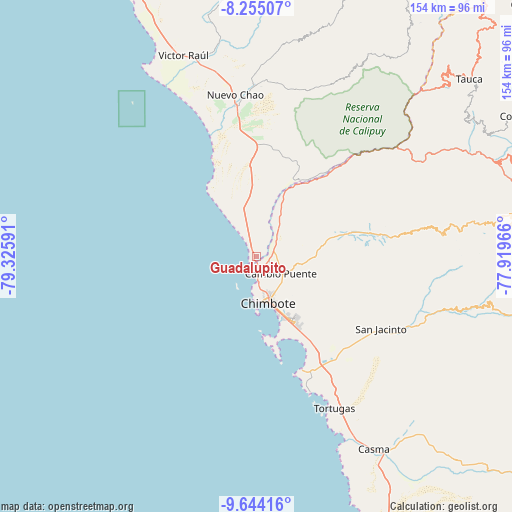
| Upper-left | -8.25507°, | -79.32591° |
| Center: | -8.95028°, | -78.62278° |
| Lower-right: | -9.64416°, | -77.91966° |
| Map W x H: | 154.5×154.5 km | = 96×96mi |
| max Lat: | -0.96667° ⇑30.8% North |
| Guadalupito: | -8.95028° |
| min Lat: | ⇓69.2% South -18.01465° |
| min Long | Guadalupito | max Long |
| -81.30472° | -78.62278° | -69.04167° |
| W 13.1%⇐ | ⇒86.9% E |
Elevation
Elevation of Guadalupito is 33 m = 108 ft, and this is 2285.7 m = 7499 ft below average elevation for this country.
| Max E: |
5022 m = 16476 ft | 94.6% |
| Avg. | 2318.7 m = 7607 ft | |
| Guadalupito | 33 m = 108 ft | |
Min E: |
1 m = 3 ft | 5.4% |
See also: Peru elevation on elevation.city.
Geographical zone
Guadalupito is located in South Torrid zone (between Equator and Tropic of Capricorn). Distance of Equator is 995.2 km =618.4 mi to North.| Distance of | km | miles | from Guadalupito |
|---|---|---|---|
| Equator | 995.2 | 618.4 | to North |
| Tropic Capricorn | 1610.7 | 1000.8 | to South |
| Antarctic Circle | 6406 | 3980.5 | to South |
| South Pole | 9011.9 | 5599.7 | to South |


Nearby cities:
15 places around Guadalupito: (largest is in red/bold)
• Buenos Aires
23.7 km =14.7 mi,  144°
144°
• Casma
68.1 km =42.3 mi,  148°
148°
• Chao
45.7 km =28.4 mi,  352°
352°
• Chimbote
15.8 km =9.8 mi,  161°
161°
• Coishco
8.1 km =5 mi,  174°
174°
• Macate
62.7 km =39 mi,  70°
70°
• Moro
52.8 km =32.8 mi,  113°
113°
• Nepeña
38.1 km =23.7 mi,  130°
130°
• Pamparomas
71.8 km =44.6 mi,  101°
101°
• Puerto Casma
62.9 km =39.1 mi, 155°
• Puerto Santa
5 km =3.1 mi,  212°
212°
• Quillo
76.5 km =47.5 mi,  123°
123°
• Samanco
37.3 km =23.2 mi, 158°
• Santa
4.4 km =2.7 mi, 164°
• Virú
61.1 km =38 mi, 346°
Sources, notices
• [Note1] Compared only with cities in Peru existing in our database
• [Src1] Map data: © OpenStreetMap contributors (CC-BY-SA)
• [Src2] Other city data from geonames.org with taken over terms of usage.
• [Src3] Geographical zone / Annual Mean Temperature by Robert A. Rohde @ Wikipedia
