Pacocha geodata
Pacocha (Moquegua) is a populated place; located in Peru in America/Lima (GMT-5) time zone. With population of 7,588 people, there are 175 cities with bigger population in this country. Compared to other cities in Peru, 99.5% of cities are located further ↑North; 87.7% of cities are located further ←West and 90.4% of cities have higher elevation than Pacocha. Note1


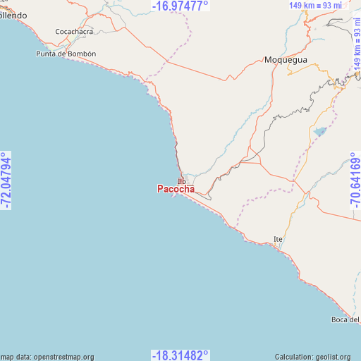
Pacocha GPS coordinates[2]
17° 38' 45.744" South, 71° 20' 41.316" West
| Map corner | latitude | longitude |
|---|---|---|
| Upper-left | -16.97477°, | -72.04794° |
| Center: | -17.64604°, | -71.34481° |
| Lower-right: | -18.31482°, | -70.64169° |
| Map W x H: | 149×149 km | = 92.6×92.6mi |
| max Lat: | -0.96667° ⇑99.5% North |
| Pacocha: | -17.64604° |
| min Lat: | ⇓0.5% South -18.01465° |
| min Long | Pacocha | max Long |
| -81.30472° | -71.34481° | -69.04167° |
| W 87.7%⇐ | ⇒12.3% E |
Elevation
Elevation of Pacocha is 83 m = 272 ft, and this is 2235.7 m = 7335 ft below average elevation for this country.
| Max E: |
5022 m = 16476 ft | 90.4% |
| Avg. | 2318.7 m = 7607 ft | |
| Pacocha | 83 m = 272 ft | |
Min E: |
1 m = 3 ft | 9.6% |
See also: Peru elevation on elevation.city.
Geographical zone
Pacocha is located in South Torrid zone (between Equator and Tropic of Capricorn). Distance of this Southern Tropic circle is 643.9 km =400.1 mi to South.| Distance of | km | miles | from Pacocha |
|---|---|---|---|
| Equator | 1962.1 | 1219.2 | to North |
| Tropic Capricorn | 643.9 | 400.1 | to South |
| Antarctic Circle | 5439.1 | 3379.7 | to South |
| South Pole | 8045 | 4998.9 | to South |


Nearby cities:
15 places around Pacocha: (largest is in red/bold)
• Cocachacra
75.9 km =47.2 mi,  324°
324°
• El Algarrobal
8.6 km =5.3 mi,  72°
72°
• Ilabaya
91.6 km =56.9 mi, 74°
• Ilo
1.6 km =1 mi,  14°
14°
• La Capilla
100.4 km =62.4 mi, 10°
• La Curva
75.1 km =46.7 mi, 317°
• Las Yaras
86.3 km =53.6 mi,  106°
106°
• Locumba
61.8 km =38.4 mi,  86°
86°
• Mollendo
99.3 km =61.7 mi,  314°
314°
• Moquegua
66 km =41 mi,  41°
41°
• Pueblo Nuevo
3.5 km =2.2 mi, 11°
• Punta de Bombón
71 km =44.1 mi, 317°
• Sama Grande
91.5 km =56.9 mi,  100°
100°
• Samegua
70.2 km =43.6 mi, 42°
• Torata
82.7 km =51.4 mi, 40°
Sources, notices
• [Note1] Compared only with cities in Peru existing in our database
• [Src1] Map data: © OpenStreetMap contributors (CC-BY-SA)
• [Src2] Other city data from geonames.org with taken over terms of usage.
• [Src3] Geographical zone / Annual Mean Temperature by Robert A. Rohde @ Wikipedia
