Estacion geodata
Estacion (Central Luzon) is a populated place; located in Philippines in Asia/Manila (GMT+8) time zone. With population of 4,478 people, there are 1506 cities with bigger population in this country. Compared to other cities in Philippines, 83.9% of cities are located further ↓South; 87.9% of cities are located further →East and 50.3% of cities have higher elevation than Estacion. Note1


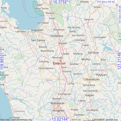
Estacion GPS coordinates[2]
15° 41' 57.984" North, 120° 36' 29.988" East
| Map corner | latitude | longitude |
|---|---|---|
| Upper-left | 16.3752°, | 119.90521° |
| Center: | 15.69944°, | 120.60833° |
| Lower-right: | 15.02144°, | 121.31146° |
| Map W x H: | 150.5×150.5 km | = 93.5×93.5mi |
| max Lat: | 20.78733° ⇑16.1% North |
| Estacion: | 15.69944° |
| min Lat: | ⇓83.9% South 4.65442° |
| min Long | Estacion | max Long |
| 117.04868° | 120.60833° | 126.58417° |
| W 12.1%⇐ | ⇒87.9% E |
Elevation
Elevation of Estacion is 23 m = 75 ft, and this is 64.9 m = 213 ft below average elevation for this country.
| Max E: |
2262 m = 7421 ft | 50.3% |
| Avg. | 87.9 m = 288 ft | |
| Estacion | 23 m = 75 ft | |
Min E: |
-2 m = -7 ft | 49.7% |
See also: Philippines elevation on elevation.city.
Geographical zone
Estacion is located in North Torrid zone (between Equator and Tropic of Cancer). Distance of this Northern Tropic circle is 860.3 km =534.6 mi to North.| Distance of | km | miles | from Estacion |
|---|---|---|---|
| North Pole | 8261.4 | 5133.4 | to North |
| Arctic Circle | 5655.6 | 3514.2 | to North |
| Tropic Cancer | 860.3 | 534.6 | to North |
| Equator | 1745.6 | 1084.7 | to South |


Nearby cities:
15 places around Estacion: (largest is in red/bold)
• Anao
3.8 km =2.4 mi,  28°
28°
• Balite
7.1 km =4.4 mi,  149°
149°
• Baquero Norte
6.1 km =3.8 mi,  287°
287°
• Buenlag
8.5 km =5.3 mi,  199°
199°
• Burgos
5.1 km =3.2 mi,  310°
310°
• Cabayaoasan
7.3 km =4.5 mi,  236°
236°
• Lanat
10.3 km =6.4 mi,  357°
357°
• Moncada
5.4 km =3.4 mi,  317°
317°
• Nampicuan
4 km =2.5 mi, 26°
• Nancamarinan
8.2 km =5.1 mi,  250°
250°
• Pance
1.8 km =1.1 mi,  133°
133°
• Paniqui
4.5 km =2.8 mi,  221°
221°
• Pura
9.3 km =5.8 mi, 152°
• Ramos
5.1 km =3.2 mi,  137°
137°
• Sapang
9 km =5.6 mi,  272°
272°
Sources, notices
• [Note1] Compared only with cities in Philippines existing in our database
• [Src1] Map data: © OpenStreetMap contributors (CC-BY-SA)
• [Src2] Other city data from geonames.org with taken over terms of usage.
• [Src3] Geographical zone / Annual Mean Temperature by Robert A. Rohde @ Wikipedia
