Saddiqabad geodata
Saddiqabad (Punjab) is a populated place; located in Pakistan in Asia/Karachi (GMT+5) time zone. With population of 189,876 people, there are 35 cities with bigger population in this country. Compared to other cities in Pakistan, 70% of cities are located further ↑North; 62.1% of cities are located further →East and 70.7% of cities have higher elevation than Saddiqabad. Note1


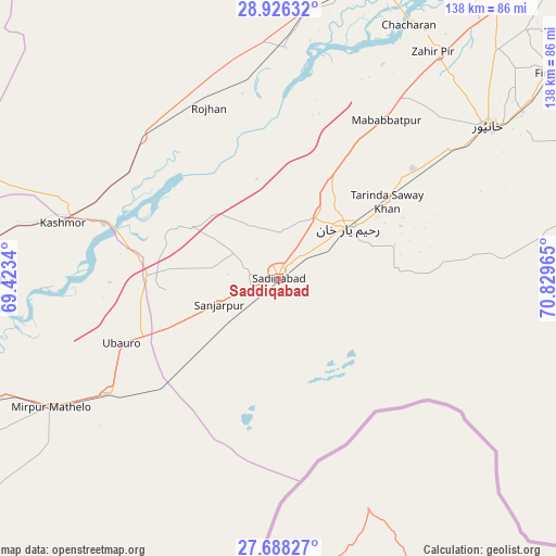
Saddiqabad GPS coordinates[2]
28° 18' 32.76" North, 70° 7' 35.472" East
| Map corner | latitude | longitude |
|---|---|---|
| Upper-left | 28.92632°, | 69.4234° |
| Center: | 28.3091°, | 70.12652° |
| Lower-right: | 27.68827°, | 70.82965° |
| Map W x H: | 137.7×137.7 km | = 85.6×85.6mi |
| max Lat: | 36.32162° ⇑70% North |
| Saddiqabad: | 28.3091° |
| min Lat: | ⇓30% South 24.14422° |
| min Long | Saddiqabad | max Long |
| 61.74573° | 70.12652° | 75.63372° |
| W 37.9%⇐ | ⇒62.1% E |
Elevation
Elevation of Saddiqabad is 78 m = 256 ft, and this is 267 m = 876 ft below average elevation for this country.
| Max E: |
2732 m = 8963 ft | 70.7% |
| Avg. | 345 m = 1132 ft | |
| Saddiqabad | 78 m = 256 ft | |
Min E: |
3 m = 10 ft | 29.3% |
See also: Saddiqabad elevation on elevation.city.
Geographical zone
Saddiqabad is located in North temperate zone (between Tropic of Cancer and the Arctic Circle). Distance of this Northern Tropic circle is 541.8 km =336.7 mi to South.| Distance of | km | miles | from Saddiqabad |
|---|---|---|---|
| North Pole | 6859.4 | 4262.2 | to North |
| Arctic Circle | 4253.5 | 2643 | to North |
| Tropic Cancer | 541.8 | 336.7 | to South |
| Equator | 3147.7 | 1955.9 | to South |


Nearby cities:
15 places around Saddiqabad: (largest is in red/bold)
• Adilpur
89.3 km =55.5 mi,  242°
242°
• Ghauspur
104 km =64.6 mi,  259°
259°
• Ghotki
86.4 km =53.7 mi,  246°
246°
• Kandhkot
93 km =57.8 mi,  265°
265°
• Kashmor
54.9 km =34.1 mi,  284°
284°
• Khairpur
49.6 km =30.8 mi, 236°
• Khanpur
64 km =39.8 mi,  54°
54°
• Khanpur Mahar
87.2 km =54.2 mi,  233°
233°
• Kot Samaba
43 km =26.7 mi, 51°
• Mirpur Mathelo
65 km =40.4 mi, 240°
• Rahim Yar Khan
21.2 km =13.2 mi, 54°
• Rajanpur
90.6 km =56.3 mi,  12°
12°
• Rojhan
45.3 km =28.1 mi,  338°
338°
• Ubauro
41.9 km =26 mi, 247°
• Zahir Pir
68.1 km =42.3 mi,  34°
34°
Sources, notices
• [Note1] Compared only with cities in Pakistan existing in our database
• [Src1] Map data: © OpenStreetMap contributors (CC-BY-SA)
• [Src2] Other city data from geonames.org with taken over terms of usage.
• [Src3] Geographical zone / Annual Mean Temperature by Robert A. Rohde @ Wikipedia
