Rajanpur geodata
Rajanpur (Punjab) is a seat of a second-order administrative division; located in Pakistan in Asia/Karachi (GMT+5) time zone. With population of 50,682 people, there are 125 cities with bigger population in this country. Compared to other cities in Pakistan, 66.1% of cities are located further ↑North; 61.4% of cities are located further →East and 68.6% of cities have higher elevation than Rajanpur. Note1


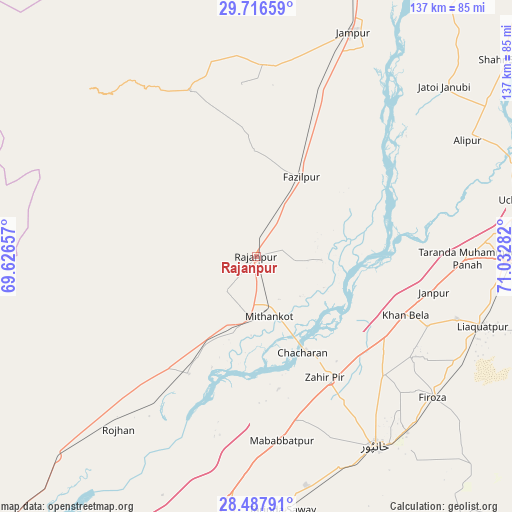
Rajanpur GPS coordinates[2]
29° 6' 14.688" North, 70° 19' 46.884" East
| Map corner | latitude | longitude |
|---|---|---|
| Upper-left | 29.71659°, | 69.62657° |
| Center: | 29.10408°, | 70.32969° |
| Lower-right: | 28.48791°, | 71.03282° |
| Map W x H: | 136.6×136.6 km | = 84.9×84.9mi |
| max Lat: | 36.32162° ⇑66.1% North |
| Rajanpur: | 29.10408° |
| min Lat: | ⇓33.9% South 24.14422° |
| min Long | Rajanpur | max Long |
| 61.74573° | 70.32969° | 75.63372° |
| W 38.6%⇐ | ⇒61.4% E |
Elevation
Elevation of Rajanpur is 95 m = 312 ft, and this is 250 m = 820 ft below average elevation for this country.
| Max E: |
2732 m = 8963 ft | 68.6% |
| Avg. | 345 m = 1132 ft | |
| Rajanpur | 95 m = 312 ft | |
Min E: |
3 m = 10 ft | 31.4% |
See also: Rajanpur elevation on elevation.city.
Geographical zone
Rajanpur is located in North temperate zone (between Tropic of Cancer and the Arctic Circle). Distance of this Northern Tropic circle is 630.2 km =391.6 mi to South.| Distance of | km | miles | from Rajanpur |
|---|---|---|---|
| North Pole | 6771 | 4207.3 | to North |
| Arctic Circle | 4165.1 | 2588.1 | to North |
| Tropic Cancer | 630.2 | 391.6 | to South |
| Equator | 3236.1 | 2010.8 | to South |


Nearby cities:
15 places around Rajanpur: (largest is in red/bold)
• Ahmadpur East
90.2 km =56 mi,  87°
87°
• Alipur
64.3 km =40 mi,  61°
61°
• Dajal
50.6 km =31.4 mi,  5°
5°
• Dera Ghazi Khan
108.9 km =67.7 mi,  16°
16°
• Jalalpur Pirwala
97.3 km =60.5 mi, 62°
• Jampur
65.1 km =40.5 mi, 23°
• Jatoi Shimali
67.9 km =42.2 mi,  47°
47°
• Kashmor
104.2 km =64.7 mi,  224°
224°
• Khanpur
59.9 km =37.2 mi,  147°
147°
• Kot Samaba
62.8 km =39 mi,  167°
167°
• Rahim Yar Khan
76.1 km =47.3 mi,  181°
181°
• Rojhan
59.1 km =36.7 mi, 218°
• Saddiqabad
90.6 km =56.3 mi,  192°
192°
• Shahr Sultan
85.1 km =52.9 mi, 52°
• Zahir Pir
37.5 km =23.3 mi, 149°
Sources, notices
• [Note1] Compared only with cities in Pakistan existing in our database
• [Src1] Map data: © OpenStreetMap contributors (CC-BY-SA)
• [Src2] Other city data from geonames.org with taken over terms of usage.
• [Src3] Geographical zone / Annual Mean Temperature by Robert A. Rohde @ Wikipedia
