Zahir Pir geodata
Zahir Pir (Punjab) is a populated place; located in Pakistan in Asia/Karachi (GMT+5) time zone. With population of 34,121 people, there are 185 cities with bigger population in this country. Compared to other cities in Pakistan, 67.3% of cities are located further ↑North; 59.8% of cities are located further →East and 68.8% of cities have higher elevation than Zahir Pir. Note1


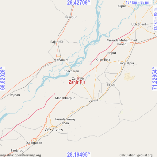
Zahir Pir GPS coordinates[2]
28° 48' 46.224" North, 70° 31' 24.276" East
| Map corner | latitude | longitude |
|---|---|---|
| Upper-left | 29.42709°, | 69.82029° |
| Center: | 28.81284°, | 70.52341° |
| Lower-right: | 28.19495°, | 71.22654° |
| Map W x H: | 137×137 km | = 85.1×85.1mi |
| max Lat: | 36.32162° ⇑67.3% North |
| Zahir Pir: | 28.81284° |
| min Lat: | ⇓32.7% South 24.14422° |
| min Long | Zahir Pir | max Long |
| 61.74573° | 70.52341° | 75.63372° |
| W 40.2%⇐ | ⇒59.8% E |
Elevation
Elevation of Zahir Pir is 93 m = 305 ft, and this is 252 m = 827 ft below average elevation for this country.
| Max E: |
2732 m = 8963 ft | 68.8% |
| Avg. | 345 m = 1132 ft | |
| Zahir Pir | 93 m = 305 ft | |
Min E: |
3 m = 10 ft | 31.2% |
See also: Pakistan elevation on elevation.city.
Geographical zone
Zahir Pir is located in North temperate zone (between Tropic of Cancer and the Arctic Circle). Distance of this Northern Tropic circle is 597.8 km =371.5 mi to South.| Distance of | km | miles | from Zahir Pir |
|---|---|---|---|
| North Pole | 6803.4 | 4227.4 | to North |
| Arctic Circle | 4197.5 | 2608.2 | to North |
| Tropic Cancer | 597.8 | 371.5 | to South |
| Equator | 3203.7 | 1990.7 | to South |


Nearby cities:
15 places around Zahir Pir: (largest is in red/bold)
• Ahmadpur East
80.3 km =49.9 mi,  62°
62°
• Alipur
73.7 km =45.8 mi,  30°
30°
• Dajal
84 km =52.2 mi,  350°
350°
• Jalalpur Pirwala
102.6 km =63.8 mi,  41°
41°
• Jampur
92.5 km =57.5 mi,  4°
4°
• Jatoi Shimali
84.4 km =52.4 mi,  21°
21°
• Kashmor
101 km =62.8 mi,  245°
245°
• Khanpur
22.5 km =14 mi,  144°
144°
• Kot Samaba
29.5 km =18.3 mi,  190°
190°
• Rahim Yar Khan
48.7 km =30.3 mi,  206°
206°
• Rajanpur
37.5 km =23.3 mi,  329°
329°
• Rojhan
57.3 km =35.6 mi,  255°
255°
• Saddiqabad
68.1 km =42.3 mi, 214°
• Shahr Sultan
97.6 km =60.6 mi, 29°
• Ubauro
105.8 km =65.7 mi,  227°
227°
Sources, notices
• [Note1] Compared only with cities in Pakistan existing in our database
• [Src1] Map data: © OpenStreetMap contributors (CC-BY-SA)
• [Src2] Other city data from geonames.org with taken over terms of usage.
• [Src3] Geographical zone / Annual Mean Temperature by Robert A. Rohde @ Wikipedia
