Khanpur geodata
Khanpur (Punjab) is a populated place; located in Pakistan in Asia/Karachi (GMT+5) time zone. With population of 142,426 people, there are 44 cities with bigger population in this country. Compared to other cities in Pakistan, 67.7% of cities are located further ↑North; 58.7% of cities are located further →East and 69.3% of cities have higher elevation than Khanpur. Note1


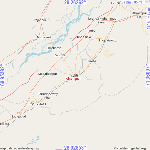
Khanpur GPS coordinates[2]
28° 38' 50.604" North, 70° 39' 24.984" East
| Map corner | latitude | longitude |
|---|---|---|
| Upper-left | 29.26262°, | 69.95382° |
| Center: | 28.64739°, | 70.65694° |
| Lower-right: | 28.02853°, | 71.36007° |
| Map W x H: | 137.2×137.2 km | = 85.3×85.3mi |
| max Lat: | 36.32162° ⇑67.7% North |
| Khanpur: | 28.64739° |
| min Lat: | ⇓32.3% South 24.14422° |
| min Long | Khanpur | max Long |
| 61.74573° | 70.65694° | 75.63372° |
| W 41.3%⇐ | ⇒58.7% E |
Elevation
Elevation of Khanpur is 90 m = 295 ft, and this is 255 m = 837 ft below average elevation for this country.
| Max E: |
2732 m = 8963 ft | 69.3% |
| Avg. | 345 m = 1132 ft | |
| Khanpur | 90 m = 295 ft | |
Min E: |
3 m = 10 ft | 30.7% |
See also: Khanpur elevation on elevation.city.
Geographical zone
Khanpur is located in North temperate zone (between Tropic of Cancer and the Arctic Circle). Distance of this Northern Tropic circle is 579.4 km =360 mi to South.| Distance of | km | miles | from Khanpur |
|---|---|---|---|
| North Pole | 6821.8 | 4238.9 | to North |
| Arctic Circle | 4215.9 | 2619.6 | to North |
| Tropic Cancer | 579.4 | 360 | to South |
| Equator | 3185.3 | 1979.3 | to South |


Nearby cities:
15 places around Khanpur: (largest is in red/bold)
• Ahmadpur East
80.3 km =49.9 mi,  46°
46°
• Alipur
85.4 km =53.1 mi,  16°
16°
• Dajal
104.8 km =65.1 mi,  344°
344°
• Jalalpur Pirwala
110 km =68.4 mi,  29°
29°
• Jampur
110.8 km =68.8 mi,  356°
356°
• Jatoi Shimali
98.5 km =61.2 mi,  10°
10°
• Kashmor
107.5 km =66.8 mi,  257°
257°
• Kot Samaba
21.2 km =13.2 mi,  240°
240°
• Rahim Yar Khan
42.8 km =26.6 mi,  233°
233°
• Rajanpur
59.9 km =37.2 mi,  327°
327°
• Rojhan
68.8 km =42.8 mi,  273°
273°
• Saddiqabad
64 km =39.8 mi, 234°
• Shahr Sultan
109.1 km =67.8 mi, 18°
• Ubauro
105.3 km =65.4 mi, 239°
• Zahir Pir
22.5 km =14 mi,  324°
324°
Sources, notices
• [Note1] Compared only with cities in Pakistan existing in our database
• [Src1] Map data: © OpenStreetMap contributors (CC-BY-SA)
• [Src2] Other city data from geonames.org with taken over terms of usage.
• [Src3] Geographical zone / Annual Mean Temperature by Robert A. Rohde @ Wikipedia
