Rahim Yar Khan geodata
Rahim Yar Khan (Punjab) is a seat of a second-order administrative division; located in Pakistan in Asia/Karachi (GMT+5) time zone. With population of 788,915 people, there are 8 cities with bigger population in this country. Compared to other cities in Pakistan, 69.5% of cities are located further ↑North; 61.6% of cities are located further →East and 70% of cities have higher elevation than Rahim Yar Khan. Note1


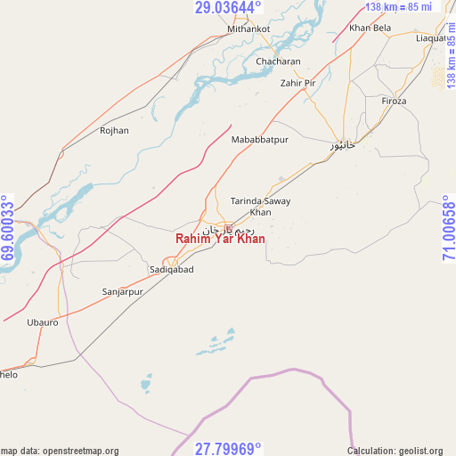
Rahim Yar Khan GPS coordinates[2]
28° 25' 11.532" North, 70° 18' 12.42" East
| Map corner | latitude | longitude |
|---|---|---|
| Upper-left | 29.03644°, | 69.60033° |
| Center: | 28.41987°, | 70.30345° |
| Lower-right: | 27.79969°, | 71.00658° |
| Map W x H: | 137.5×137.5 km | = 85.4×85.4mi |
| max Lat: | 36.32162° ⇑69.5% North |
| Rahim Yar Khan: | 28.41987° |
| min Lat: | ⇓30.5% South 24.14422° |
| min Long | Rahim Yar Khan | max Long |
| 61.74573° | 70.30345° | 75.63372° |
| W 38.4%⇐ | ⇒61.6% E |
Elevation
Elevation of Rahim Yar Khan is 85 m = 279 ft, and this is 260 m = 853 ft below average elevation for this country.
| Max E: |
2732 m = 8963 ft | 70% |
| Avg. | 345 m = 1132 ft | |
| Rahim Yar Khan | 85 m = 279 ft | |
Min E: |
3 m = 10 ft | 30% |
See also: Rahim Yar Khan elevation on elevation.city.
Geographical zone
Rahim Yar Khan is located in North temperate zone (between Tropic of Cancer and the Arctic Circle). Distance of this Northern Tropic circle is 554.1 km =344.3 mi to South.| Distance of | km | miles | from Rahim Yar Khan |
|---|---|---|---|
| North Pole | 6847.1 | 4254.6 | to North |
| Arctic Circle | 4241.2 | 2635.4 | to North |
| Tropic Cancer | 554.1 | 344.3 | to South |
| Equator | 3160 | 1963.5 | to South |


Nearby cities:
15 places around Rahim Yar Khan: (largest is in red/bold)
• Adilpur
110.4 km =68.6 mi,  240°
240°
• Alipur
122.3 km =76 mi,  28°
28°
• Ghotki
107.2 km =66.6 mi, 244°
• Kandhkot
111.7 km =69.4 mi,  260°
260°
• Kashmor
70.4 km =43.7 mi,  271°
271°
• Khairpur
70.8 km =44 mi, 236°
• Khanpur
42.8 km =26.6 mi,  53°
53°
• Khanpur Mahar
108.5 km =67.4 mi,  233°
233°
• Kot Samaba
21.8 km =13.5 mi, 47°
• Mirpur Mathelo
86.2 km =53.6 mi, 239°
• Rajanpur
76.1 km =47.3 mi,  1°
1°
• Rojhan
45.3 km =28.1 mi,  311°
311°
• Saddiqabad
21.2 km =13.2 mi, 234°
• Ubauro
62.8 km =39 mi, 243°
• Zahir Pir
48.7 km =30.3 mi, 26°
In other languages:
- In German: Rahimyar Khan
- In Italian: Rahimyar Khan
- In Russian: Рахимъярхан
- In Chinese: 拉希姆亞爾汗
Sources, notices
• [Note1] Compared only with cities in Pakistan existing in our database
• [Src1] Map data: © OpenStreetMap contributors (CC-BY-SA)
• [Src2] Other city data from geonames.org with taken over terms of usage.
• [Src3] Geographical zone / Annual Mean Temperature by Robert A. Rohde @ Wikipedia
