Qila Abdullah geodata
Qila Abdullah (Balochistan) is a seat of a second-order administrative division; located in Pakistan in Asia/Karachi (GMT+5) time zone. In our database, there are 416 cities with bigger population. Compared to other cities in Pakistan, 50.6% of cities are located further ↑North; 96.4% of cities are located further →East and 95.9% of cities have lower elevation than Qila Abdullah. Note1


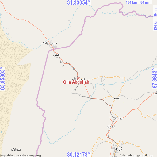
Qila Abdullah GPS coordinates[2]
30° 43' 40.908" North, 66° 39' 40.212" East
| Map corner | latitude | longitude |
|---|---|---|
| Upper-left | 31.33054°, | 65.95805° |
| Center: | 30.72803°, | 66.66117° |
| Lower-right: | 30.12173°, | 67.3643° |
| Map W x H: | 134.4×134.4 km | = 83.5×83.5mi |
| max Lat: | 36.32162° ⇑50.6% North |
| Qila Abdullah: | 30.72803° |
| min Lat: | ⇓49.4% South 24.14422° |
| min Long | Qila Abdullah | max Long |
| 61.74573° | 66.66117° | 75.63372° |
| W 3.6%⇐ | ⇒96.4% E |
Elevation
Elevation of Qila Abdullah is 1562 m = 5125 ft, and this is 1217 m = 3993 ft above average elevation for this country.
| Max E: |
2732 m = 8963 ft | 4.1% |
| Qila Abdullah | 1562 m 5125 ft | |
| Avg. | 345 m = 1132 ft | |
Min E: |
3 m = 10 ft | 95.9% |
See also: Pakistan elevation on elevation.city.
Geographical zone
Qila Abdullah is located in North temperate zone (between Tropic of Cancer and the Arctic Circle). Distance of this Northern Tropic circle is 810.7 km =503.7 mi to South.| Distance of | km | miles | from Qila Abdullah |
|---|---|---|---|
| North Pole | 6590.4 | 4095.1 | to North |
| Arctic Circle | 3984.5 | 2475.9 | to North |
| Tropic Cancer | 810.7 | 503.7 | to South |
| Equator | 3416.6 | 2123 | to South |


Nearby cities:
15 places around Qila Abdullah: (largest is in red/bold)
• Alik Ghund
86.5 km =53.7 mi,  107°
107°
• Chaman
29 km =18 mi,  316°
316°
• Dadhar
168.8 km =104.9 mi,  145°
145°
• Harnai
140.9 km =87.6 mi,  119°
119°
• Kalat
189.3 km =117.6 mi,  181°
181°
• Khadan Khak
100.4 km =62.4 mi,  88°
88°
• Kot Malik Barkhurdar
66.1 km =41.1 mi, 151°
• Mach
115.6 km =71.8 mi, 146°
• Mastung
104.7 km =65.1 mi,  170°
170°
• Nushki
144.4 km =89.7 mi,  205°
205°
• Pishin
35.8 km =22.2 mi, 117°
• Qila Saifullah
162.4 km =100.9 mi, 91°
• Quetta
68.7 km =42.7 mi, 151°
• Sibi
176.2 km =109.5 mi,  138°
138°
• Ziarat
108.9 km =67.7 mi, 110°
Sources, notices
• [Note1] Compared only with cities in Pakistan existing in our database
• [Src1] Map data: © OpenStreetMap contributors (CC-BY-SA)
• [Src2] Other city data from geonames.org with taken over terms of usage.
• [Src3] Geographical zone / Annual Mean Temperature by Robert A. Rohde @ Wikipedia
