Mastung geodata
Mastung (Balochistan) is a seat of a second-order administrative division; located in Pakistan in Asia/Karachi (GMT+5) time zone. With population of 29,082 people, there are 216 cities with bigger population in this country. Compared to other cities in Pakistan, 60.7% of cities are located further ↑North; 95.9% of cities are located further →East and 96.6% of cities have lower elevation than Mastung. Note1


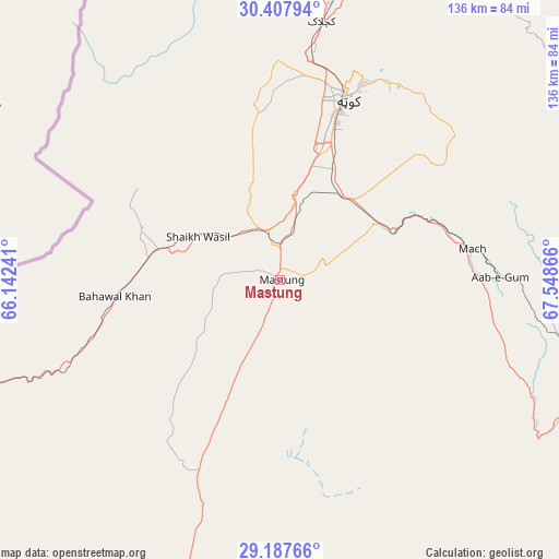
Mastung GPS coordinates[2]
29° 47' 58.776" North, 66° 50' 43.908" East
| Map corner | latitude | longitude |
|---|---|---|
| Upper-left | 30.40794°, | 66.14241° |
| Center: | 29.79966°, | 66.84553° |
| Lower-right: | 29.18766°, | 67.54866° |
| Map W x H: | 135.7×135.7 km | = 84.3×84.3mi |
| max Lat: | 36.32162° ⇑60.7% North |
| Mastung: | 29.79966° |
| min Lat: | ⇓39.3% South 24.14422° |
| min Long | Mastung | max Long |
| 61.74573° | 66.84553° | 75.63372° |
| W 4.1%⇐ | ⇒95.9% E |
Elevation
Elevation of Mastung is 1682 m = 5518 ft, and this is 1337 m = 4386 ft above average elevation for this country.
| Max E: |
2732 m = 8963 ft | 3.4% |
| Mastung | 1682 m 5518 ft | |
| Avg. | 345 m = 1132 ft | |
Min E: |
3 m = 10 ft | 96.6% |
See also: Pakistan elevation on elevation.city.
Geographical zone
Mastung is located in North temperate zone (between Tropic of Cancer and the Arctic Circle). Distance of this Northern Tropic circle is 707.5 km =439.6 mi to South.| Distance of | km | miles | from Mastung |
|---|---|---|---|
| North Pole | 6693.7 | 4159.3 | to North |
| Arctic Circle | 4087.8 | 2540 | to North |
| Tropic Cancer | 707.5 | 439.6 | to South |
| Equator | 3313.4 | 2058.9 | to South |


Nearby cities:
15 places around Mastung: (largest is in red/bold)
• Alik Ghund
100.6 km =62.5 mi,  40°
40°
• Bhag
126.8 km =78.8 mi,  131°
131°
• Chaman
129.9 km =80.7 mi,  343°
343°
• Dadhar
85.9 km =53.4 mi,  114°
114°
• Harnai
110.5 km =68.7 mi,  72°
72°
• Kalat
89.3 km =55.5 mi,  195°
195°
• Khadan Khak
134.7 km =83.7 mi, 38°
• Kot Malik Barkhurdar
47 km =29.2 mi,  16°
16°
• Mach
47.3 km =29.4 mi,  81°
81°
• Nushki
84.1 km =52.3 mi,  250°
250°
• Pishin
88.1 km =54.7 mi,  9°
9°
• Qila Abdullah
104.7 km =65.1 mi,  350°
350°
• Quetta
45.3 km =28.1 mi, 19°
• Sibi
103.7 km =64.4 mi, 105°
• Ziarat
106.6 km =66.2 mi,  52°
52°
Sources, notices
• [Note1] Compared only with cities in Pakistan existing in our database
• [Src1] Map data: © OpenStreetMap contributors (CC-BY-SA)
• [Src2] Other city data from geonames.org with taken over terms of usage.
• [Src3] Geographical zone / Annual Mean Temperature by Robert A. Rohde @ Wikipedia
