Chaman geodata
Chaman (Balochistan) is a populated place; located in Pakistan in Asia/Karachi (GMT+5) time zone. With population of 88,568 people, there are 73 cities with bigger population in this country. Compared to other cities in Pakistan, 53.5% of cities are located further ↓South; 97.3% of cities are located further →East and 92.8% of cities have lower elevation than Chaman. Note1


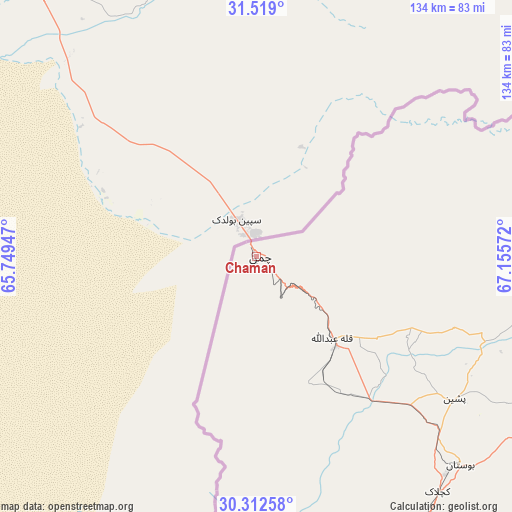
Chaman GPS coordinates[2]
30° 55' 3.684" North, 66° 27' 9.324" East
| Map corner | latitude | longitude |
|---|---|---|
| Upper-left | 31.519°, | 65.74947° |
| Center: | 30.91769°, | 66.45259° |
| Lower-right: | 30.31258°, | 67.15572° |
| Map W x H: | 134.1×134.1 km | = 83.3×83.3mi |
| max Lat: | 36.32162° ⇑46.5% North |
| Chaman: | 30.91769° |
| min Lat: | ⇓53.5% South 24.14422° |
| min Long | Chaman | max Long |
| 61.74573° | 66.45259° | 75.63372° |
| W 2.7%⇐ | ⇒97.3% E |
Elevation
Elevation of Chaman is 1336 m = 4383 ft, and this is 991 m = 3251 ft above average elevation for this country.
| Max E: |
2732 m = 8963 ft | 7.2% |
| Chaman | 1336 m 4383 ft | |
| Avg. | 345 m = 1132 ft | |
Min E: |
3 m = 10 ft | 92.8% |
See also: Chaman elevation on elevation.city.
Geographical zone
Chaman is located in North temperate zone (between Tropic of Cancer and the Arctic Circle). Distance of this Northern Tropic circle is 831.8 km =516.9 mi to South.| Distance of | km | miles | from Chaman |
|---|---|---|---|
| North Pole | 6569.3 | 4082 | to North |
| Arctic Circle | 3963.4 | 2462.7 | to North |
| Tropic Cancer | 831.8 | 516.9 | to South |
| Equator | 3437.7 | 2136.1 | to South |


Nearby cities:
15 places around Chaman: (largest is in red/bold)
• Alik Ghund
112.7 km =70 mi,  114°
114°
• Dadhar
197.5 km =122.7 mi,  144°
144°
• Harnai
168.8 km =104.9 mi,  122°
122°
• Kalat
210.7 km =130.9 mi,  176°
176°
• Khadan Khak
121.6 km =75.6 mi,  98°
98°
• Kot Malik Barkhurdar
94.5 km =58.7 mi,  147°
147°
• Mach
144.3 km =89.7 mi, 144°
• Mastung
129.9 km =80.7 mi,  163°
163°
• Nushki
157.3 km =97.7 mi,  195°
195°
• Pishin
63.8 km =39.6 mi,  125°
125°
• Qila Abdullah
29 km =18 mi, 136°
• Qila Saifullah
183.7 km =114.1 mi, 97°
• Quetta
97 km =60.3 mi, 147°
• Sibi
205.2 km =127.5 mi, 138°
• Ziarat
135.5 km =84.2 mi, 116°
Sources, notices
• [Note1] Compared only with cities in Pakistan existing in our database
• [Src1] Map data: © OpenStreetMap contributors (CC-BY-SA)
• [Src2] Other city data from geonames.org with taken over terms of usage.
• [Src3] Geographical zone / Annual Mean Temperature by Robert A. Rohde @ Wikipedia
