Wolbrom geodata
Wolbrom (Lesser Poland) is a seat of a third-order administrative division; located in Poland in Europe/Warsaw (GMT+2) time zone. With population of 9,146 people, there are 474 cities with bigger population in this country. Compared to other cities in Poland, 70% of cities are located further ↑North; 53.8% of cities are located further ←West and 93.3% of cities have lower elevation than Wolbrom. Note1


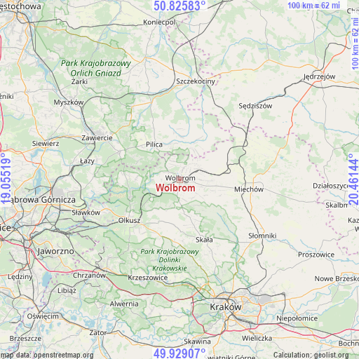
Wolbrom GPS coordinates[2]
50° 22' 46.452" North, 19° 45' 29.916" East
| Map corner | latitude | longitude |
|---|---|---|
| Upper-left | 50.82583°, | 19.05519° |
| Center: | 50.37957°, | 19.75831° |
| Lower-right: | 49.92907°, | 20.46144° |
| Map W x H: | 99.7×99.7 km | = 62×62mi |
| max Lat: | 54.83135° ⇑70% North |
| Wolbrom: | 50.37957° |
| min Lat: | ⇓30% South 49.21328° |
| min Long | Wolbrom | max Long |
| 14.20249° | 19.75831° | 24.03723° |
| W 53.8%⇐ | ⇒46.2% E |
Elevation
Elevation of Wolbrom is 375 m = 1230 ft, and this is 183.6 m = 602 ft above average elevation for this country.
| Max E: |
974 m = 3196 ft | 6.7% |
| Wolbrom | 375 m 1230 ft | |
| Avg. | 191.4 m = 628 ft | |
Min E: |
-3 m = -10 ft | 93.3% |
See also: Poland elevation on elevation.city.
Geographical zone
Wolbrom is located in North temperate zone (between Tropic of Cancer and the Arctic Circle). Distance of this North polar circle is 1799.5 km =1118.2 mi to North.| Distance of | km | miles | from Wolbrom |
|---|---|---|---|
| North Pole | 4405.4 | 2737.4 | to North |
| Arctic Circle | 1799.5 | 1118.2 | to North |
| Tropic Cancer | 2995.8 | 1861.5 | to South |
| Equator | 5601.7 | 3480.7 | to South |


Nearby cities:
15 places around Wolbrom: (largest is in red/bold)
• Klucze
14.7 km =9.1 mi,  250°
250°
• Kępie
15.4 km =9.6 mi,  55°
55°
• Miechów Charsznica
13.7 km =8.5 mi,  82°
82°
• Olkusz
17.5 km =10.9 mi,  231°
231°
• Pilica
12.2 km =7.6 mi,  323°
323°
• Poręba Górna
3.7 km =2.3 mi,  140°
140°
• Przeginia
16.5 km =10.3 mi,  197°
197°
• Sieniczno
16.2 km =10.1 mi,  219°
219°
• Skała
17.9 km =11.1 mi,  157°
157°
• Sułoszowa
12.5 km =7.8 mi,  188°
188°
• Sąspów
16.8 km =10.4 mi,  177°
177°
• Trzyciąż
7.8 km =4.8 mi, 175°
• Wierzchowisko
4.1 km =2.5 mi,  96°
96°
• Zarzecze
4.6 km =2.9 mi, 252°
• Żarnowiec
13.2 km =8.2 mi,  33°
33°
Sources, notices
• [Note1] Compared only with cities in Poland existing in our database
• [Src1] Map data: © OpenStreetMap contributors (CC-BY-SA)
• [Src2] Other city data from geonames.org with taken over terms of usage.
• [Src3] Geographical zone / Annual Mean Temperature by Robert A. Rohde @ Wikipedia
