Miechów Charsznica geodata
Miechów Charsznica (Lesser Poland) is a populated place; located in Poland in Europe/Warsaw (GMT+2) time zone. With population of 1,942 people, there are 1522 cities with bigger population in this country. Compared to other cities in Poland, 69.6% of cities are located further ↑North; 57.6% of cities are located further ←West and 88.9% of cities have lower elevation than Miechów Charsznica. Note1
Administrative division(s):
- Level 1: Lesser Poland
- Level 2: Powiat miechowski
- Level 3: Gmina Charsznica


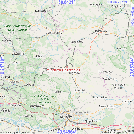
Miechów Charsznica GPS coordinates[2]
50° 23' 45.564" North, 19° 57' 1.116" East
| Map corner | latitude | longitude |
|---|---|---|
| Upper-left | 50.8421°, | 19.24719° |
| Center: | 50.39599°, | 19.95031° |
| Lower-right: | 49.94564°, | 20.65344° |
| Map W x H: | 99.7×99.7 km | = 62×62mi |
| max Lat: | 54.83135° ⇑69.6% North |
| Miechów Charsznica: | 50.39599° |
| min Lat: | ⇓30.4% South 49.21328° |
| min Long | Miechów Charsz | max Long |
| 14.20249° | 19.95031° | 24.03723° |
| W 57.6%⇐ | ⇒42.4% E |
Elevation
Elevation of Miechów Charsznica is 316 m = 1037 ft, and this is 124.6 m = 409 ft above average elevation for this country.
| Max E: |
974 m = 3196 ft | 11.1% |
| Miechów Charsznica | 316 m 1037 ft | |
| Avg. | 191.4 m = 628 ft | |
Min E: |
-3 m = -10 ft | 88.9% |
See also: Poland elevation on elevation.city.
Geographical zone
Miechów Charsznica is located in North temperate zone (between Tropic of Cancer and the Arctic Circle). Distance of this North polar circle is 1797.7 km =1117 mi to North.| Distance of | km | miles | from Miechów Charsznica |
|---|---|---|---|
| North Pole | 4403.6 | 2736.3 | to North |
| Arctic Circle | 1797.7 | 1117 | to North |
| Tropic Cancer | 2997.6 | 1862.6 | to South |
| Equator | 5603.5 | 3481.9 | to South |


Nearby cities:
15 places around Miechów Charsznica: (largest is in red/bold)
• Iwanowice
18.9 km =11.7 mi,  177°
177°
• Kozłów
11.1 km =6.9 mi,  28°
28°
• Książ Wielki
14.5 km =9 mi,  68°
68°
• Kępie
7 km =4.3 mi,  352°
352°
• Marcinowice
12.3 km =7.6 mi,  15°
15°
• Miechów
7 km =4.3 mi,  128°
128°
• Miłocice
19.3 km =12 mi,  159°
159°
• Poręba Górna
12.2 km =7.6 mi,  247°
247°
• Sieciechowice
17 km =10.6 mi,  174°
174°
• Skała
19.6 km =12.2 mi,  200°
200°
• Trzyciąż
16.1 km =10 mi,  233°
233°
• Wierzchowisko
9.9 km =6.2 mi,  256°
256°
• Wolbrom
13.7 km =8.5 mi, 262°
• Zarzecze
18.3 km =11.4 mi, 259°
• Żarnowiec
11.2 km =7 mi,  325°
325°
Sources, notices
• [Note1] Compared only with cities in Poland existing in our database
• [Src1] Map data: © OpenStreetMap contributors (CC-BY-SA)
• [Src2] Other city data from geonames.org with taken over terms of usage.
• [Src3] Geographical zone / Annual Mean Temperature by Robert A. Rohde @ Wikipedia
