Uciechów geodata
Uciechów (Lower Silesia) is a populated place; located in Poland in Europe/Warsaw (GMT+2) time zone. With population of 1,017 people, there are 2435 cities with bigger population in this country. Compared to other cities in Poland, 61.2% of cities are located further ↑North; 88.2% of cities are located further →East and 78.8% of cities have lower elevation than Uciechów. Note1
Administrative division(s):
- Level 1: Lower Silesia
- Level 2: Powiat dzierżoniowski
- Level 3: Dzierżoniów


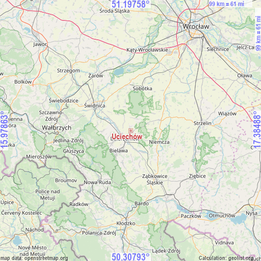
Uciechów GPS coordinates[2]
50° 45' 17.532" North, 16° 40' 54.3" East
| Map corner | latitude | longitude |
|---|---|---|
| Upper-left | 51.19758°, | 15.97863° |
| Center: | 50.75487°, | 16.68175° |
| Lower-right: | 50.30793°, | 17.38488° |
| Map W x H: | 98.9×98.9 km | = 61.5×61.5mi |
| max Lat: | 54.83135° ⇑61.2% North |
| Uciechów: | 50.75487° |
| min Lat: | ⇓38.8% South 49.21328° |
| min Long | Uciechów | max Long |
| 14.20249° | 16.68175° | 24.03723° |
| W 11.8%⇐ | ⇒88.2% E |
Elevation
Elevation of Uciechów is 260 m = 853 ft, and this is 68.6 m = 225 ft above average elevation for this country.
| Max E: |
974 m = 3196 ft | 21.2% |
| Uciechów | 260 m 853 ft | |
| Avg. | 191.4 m = 628 ft | |
Min E: |
-3 m = -10 ft | 78.8% |
See also: Poland elevation on elevation.city.
Geographical zone
Uciechów is located in North temperate zone (between Tropic of Cancer and the Arctic Circle). Distance of this North polar circle is 1757.8 km =1092.2 mi to North.| Distance of | km | miles | from Uciechów |
|---|---|---|---|
| North Pole | 4363.6 | 2711.4 | to North |
| Arctic Circle | 1757.8 | 1092.2 | to North |
| Tropic Cancer | 3037.5 | 1887.4 | to South |
| Equator | 5643.4 | 3506.6 | to South |


Nearby cities:
15 places around Uciechów: (largest is in red/bold)
• Bielawa
8.2 km =5.1 mi,  210°
210°
• Dobrocin
2.9 km =1.8 mi,  142°
142°
• Dzierżoniów
3.7 km =2.3 mi,  215°
215°
• Jodłownik
13.1 km =8.1 mi,  201°
201°
• Jordanów Śląski
17.9 km =11.1 mi,  47°
47°
• Marcinowice
15.5 km =9.6 mi,  333°
333°
• Niemcza
11.5 km =7.1 mi,  109°
109°
• Ostroszowice
12.5 km =7.8 mi,  193°
193°
• Pieszyce
8.4 km =5.2 mi,  236°
236°
• Piława Górna
9 km =5.6 mi,  151°
151°
• Sobótka
16.7 km =10.4 mi,  15°
15°
• Stoszowice
17.7 km =11 mi,  166°
166°
• Wilków Wielki
11.8 km =7.3 mi,  90°
90°
• Łagiewniki
12.1 km =7.5 mi,  70°
70°
• Świdnica
16.8 km =10.4 mi,  306°
306°
Sources, notices
• [Note1] Compared only with cities in Poland existing in our database
• [Src1] Map data: © OpenStreetMap contributors (CC-BY-SA)
• [Src2] Other city data from geonames.org with taken over terms of usage.
• [Src3] Geographical zone / Annual Mean Temperature by Robert A. Rohde @ Wikipedia
