Marcinowice geodata
Marcinowice (Lower Silesia) is a populated place; located in Poland in Europe/Warsaw (GMT+2) time zone. With population of 555 people, there are 3398 cities with bigger population in this country. Compared to other cities in Poland, 58.3% of cities are located further ↑North; 88.9% of cities are located further →East and 61% of cities have lower elevation than Marcinowice. Note1


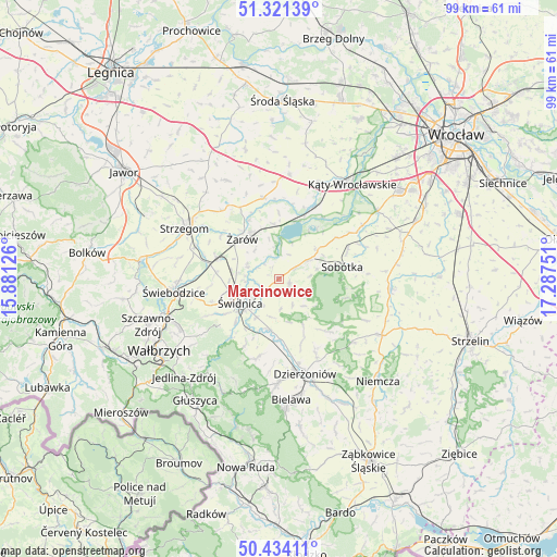
Marcinowice GPS coordinates[2]
50° 52' 47.496" North, 16° 35' 3.768" East
| Map corner | latitude | longitude |
|---|---|---|
| Upper-left | 51.32139°, | 15.88126° |
| Center: | 50.87986°, | 16.58438° |
| Lower-right: | 50.43411°, | 17.28751° |
| Map W x H: | 98.7×98.7 km | = 61.3×61.3mi |
| max Lat: | 54.83135° ⇑58.3% North |
| Marcinowice: | 50.87986° |
| min Lat: | ⇓41.7% South 49.21328° |
| min Long | Marcinowice | max Long |
| 14.20249° | 16.58438° | 24.03723° |
| W 11.1%⇐ | ⇒88.9% E |
Elevation
Elevation of Marcinowice is 203 m = 666 ft, and this is 11.6 m = 38 ft above average elevation for this country.
| Max E: |
974 m = 3196 ft | 39% |
| Marcinowice | 203 m 666 ft | |
| Avg. | 191.4 m = 628 ft | |
Min E: |
-3 m = -10 ft | 61% |
See also: Poland elevation on elevation.city.
Geographical zone
Marcinowice is located in North temperate zone (between Tropic of Cancer and the Arctic Circle). Distance of this North polar circle is 1743.9 km =1083.6 mi to North.| Distance of | km | miles | from Marcinowice |
|---|---|---|---|
| North Pole | 4349.8 | 2702.8 | to North |
| Arctic Circle | 1743.9 | 1083.6 | to North |
| Tropic Cancer | 3051.4 | 1896.1 | to South |
| Equator | 5657.3 | 3515.3 | to South |


Nearby cities:
15 places around Marcinowice: (largest is in red/bold)
• Dobrocin
18.4 km =11.4 mi,  152°
152°
• Dzierżoniów
17.5 km =10.9 mi,  164°
164°
• Dziećmorowice
20.4 km =12.7 mi,  233°
233°
• Jaworzyna Śląska
11.3 km =7 mi,  289°
289°
• Jordanów Śląski
20 km =12.4 mi,  94°
94°
• Kostomłoty
18.5 km =11.5 mi,  5°
5°
• Pieszyce
18.6 km =11.6 mi,  180°
180°
• Sobótka
11.4 km =7.1 mi,  78°
78°
• Stanowice
15.8 km =9.8 mi, 291°
• Strzegom
18.8 km =11.7 mi,  299°
299°
• Uciechów
15.5 km =9.6 mi, 153°
• Udanin
19.7 km =12.2 mi,  332°
332°
• Świdnica
7.8 km =4.8 mi,  239°
239°
• Świebodzice
18.7 km =11.6 mi,  263°
263°
• Żarów
9.3 km =5.8 mi,  317°
317°
Sources, notices
• [Note1] Compared only with cities in Poland existing in our database
• [Src1] Map data: © OpenStreetMap contributors (CC-BY-SA)
• [Src2] Other city data from geonames.org with taken over terms of usage.
• [Src3] Geographical zone / Annual Mean Temperature by Robert A. Rohde @ Wikipedia
