Suchań geodata
Suchań (West Pomerania) is a seat of a third-order administrative division; located in Poland in Europe/Warsaw (GMT+2) time zone. With population of 1,465 people, there are 1903 cities with bigger population in this country. Compared to other cities in Poland, 87.3% of cities are located further ↓South; 96.3% of cities are located further →East and 94.8% of cities have higher elevation than Suchań. Note1


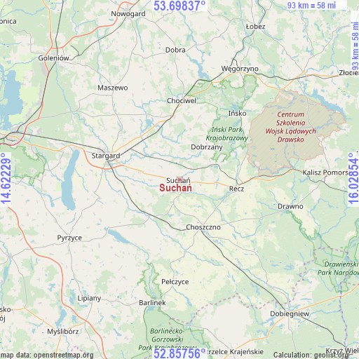
Suchań GPS coordinates[2]
53° 16' 48.108" North, 15° 19' 31.476" East
| Map corner | latitude | longitude |
|---|---|---|
| Upper-left | 53.69837°, | 14.62229° |
| Center: | 53.28003°, | 15.32541° |
| Lower-right: | 52.85756°, | 16.02854° |
| Map W x H: | 93.5×93.5 km | = 58.1×58.1mi |
| max Lat: | 54.83135° ⇑12.7% North |
| Suchań: | 53.28003° |
| min Lat: | ⇓87.3% South 49.21328° |
| min Long | Suchań | max Long |
| 14.20249° | 15.32541° | 24.03723° |
| W 3.7%⇐ | ⇒96.3% E |
Elevation
Elevation of Suchań is 43 m = 141 ft, and this is 148.4 m = 487 ft below average elevation for this country.
| Max E: |
974 m = 3196 ft | 94.8% |
| Avg. | 191.4 m = 628 ft | |
| Suchań | 43 m = 141 ft | |
Min E: |
-3 m = -10 ft | 5.2% |
See also: Poland elevation on elevation.city.
Geographical zone
Suchań is located in North temperate zone (between Tropic of Cancer and the Arctic Circle). Distance of this North polar circle is 1477 km =917.8 mi to North.| Distance of | km | miles | from Suchań |
|---|---|---|---|
| North Pole | 4082.9 | 2537 | to North |
| Arctic Circle | 1477 | 917.8 | to North |
| Tropic Cancer | 3318.3 | 2061.9 | to South |
| Equator | 5924.2 | 3681.1 | to South |


Nearby cities:
15 places around Suchań: (largest is in red/bold)
• Chociwel
20.8 km =12.9 mi,  1°
1°
• Choszczno
13.9 km =8.6 mi,  152°
152°
• Dobrzany
11.2 km =7 mi,  37°
37°
• Dolice
12.9 km =8 mi,  219°
219°
• Drawno
29.6 km =18.4 mi,  103°
103°
• Ińsko
22.9 km =14.2 mi, 40°
• Krzęcin
24.6 km =15.3 mi, 153°
• Marianowo
12.1 km =7.5 mi,  341°
341°
• Morzyczyn
28.2 km =17.5 mi,  286°
286°
• Pełczyce
26.3 km =16.3 mi,  183°
183°
• Przelewice
25.7 km =16 mi, 220°
• Recz
14.9 km =9.3 mi, 98°
• Stara Dąbrowa
19.8 km =12.3 mi,  322°
322°
• Stargard
19.4 km =12.1 mi, 289°
• Warnice
22.2 km =13.8 mi,  262°
262°
Sources, notices
• [Note1] Compared only with cities in Poland existing in our database
• [Src1] Map data: © OpenStreetMap contributors (CC-BY-SA)
• [Src2] Other city data from geonames.org with taken over terms of usage.
• [Src3] Geographical zone / Annual Mean Temperature by Robert A. Rohde @ Wikipedia
