Ińsko geodata
Ińsko (West Pomerania) is a seat of a third-order administrative division; located in Poland in Europe/Warsaw (GMT+2) time zone. With population of 2,002 people, there are 1467 cities with bigger population in this country. Compared to other cities in Poland, 89% of cities are located further ↓South; 95.1% of cities are located further →East and 69.8% of cities have higher elevation than Ińsko. Note1


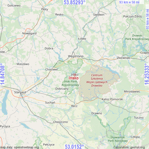
Ińsko GPS coordinates[2]
53° 26' 10.068" North, 15° 33' 0.72" East
| Map corner | latitude | longitude |
|---|---|---|
| Upper-left | 53.85293°, | 14.84708° |
| Center: | 53.43613°, | 15.5502° |
| Lower-right: | 53.0152°, | 16.25333° |
| Map W x H: | 93.1×93.1 km | = 57.8×57.8mi |
| max Lat: | 54.83135° ⇑11% North |
| Ińsko: | 53.43613° |
| min Lat: | ⇓89% South 49.21328° |
| min Long | Ińsko | max Long |
| 14.20249° | 15.5502° | 24.03723° |
| W 4.9%⇐ | ⇒95.1% E |
Elevation
Elevation of Ińsko is 121 m = 397 ft, and this is 70.4 m = 231 ft below average elevation for this country.
| Max E: |
974 m = 3196 ft | 69.8% |
| Avg. | 191.4 m = 628 ft | |
| Ińsko | 121 m = 397 ft | |
Min E: |
-3 m = -10 ft | 30.2% |
See also: Poland elevation on elevation.city.
Geographical zone
Ińsko is located in North temperate zone (between Tropic of Cancer and the Arctic Circle). Distance of this North polar circle is 1459.6 km =907 mi to North.| Distance of | km | miles | from Ińsko |
|---|---|---|---|
| North Pole | 4065.5 | 2526.2 | to North |
| Arctic Circle | 1459.6 | 907 | to North |
| Tropic Cancer | 3335.6 | 2072.6 | to South |
| Equator | 5941.5 | 3691.9 | to South |


Nearby cities:
15 places around Ińsko: (largest is in red/bold)
• Chociwel
14.8 km =9.2 mi,  283°
283°
• Choszczno
30.9 km =19.2 mi,  196°
196°
• Dobra
23.1 km =14.4 mi,  316°
316°
• Dobrzany
11.7 km =7.3 mi,  223°
223°
• Drawno
27.8 km =17.3 mi,  149°
149°
• Drawsko Pomorskie
20.1 km =12.5 mi,  58°
58°
• Kalisz Pomorski
28.1 km =17.5 mi,  122°
122°
• Marianowo
19.7 km =12.2 mi,  252°
252°
• Radowo Małe
26.4 km =16.4 mi,  345°
345°
• Recz
19.6 km =12.2 mi,  180°
180°
• Stara Dąbrowa
27 km =16.8 mi,  266°
266°
• Suchań
22.9 km =14.2 mi, 220°
• Węgorzyno
11.7 km =7.3 mi,  3°
3°
• Złocieniec
32.3 km =20.1 mi,  70°
70°
• Łobez
23.1 km =14.4 mi,  11°
11°
Sources, notices
• [Note1] Compared only with cities in Poland existing in our database
• [Src1] Map data: © OpenStreetMap contributors (CC-BY-SA)
• [Src2] Other city data from geonames.org with taken over terms of usage.
• [Src3] Geographical zone / Annual Mean Temperature by Robert A. Rohde @ Wikipedia
