Sępólno Krajeńskie geodata
Sępólno Krajeńskie (Kujawsko-Pomorskie) is a seat of a third-order administrative division; located in Poland in Europe/Warsaw (GMT+2) time zone. With population of 9,223 people, there are 469 cities with bigger population in this country. Compared to other cities in Poland, 89% of cities are located further ↓South; 79.6% of cities are located further →East and 71.1% of cities have higher elevation than Sępólno Krajeńskie. Note1
Administrative division(s):
- Level 1: Kujawsko-Pomorskie
- Level 2: Powiat sępoleński
- Level 3: Sępólno Krajeńskie


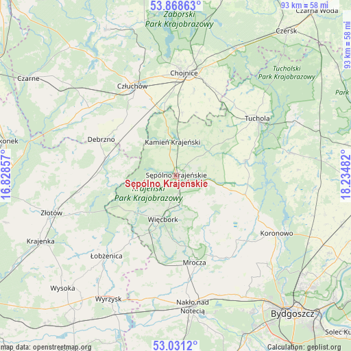
Sępólno Krajeńskie GPS coordinates[2]
53° 27' 7.128" North, 17° 31' 54.084" East
| Map corner | latitude | longitude |
|---|---|---|
| Upper-left | 53.86863°, | 16.82857° |
| Center: | 53.45198°, | 17.53169° |
| Lower-right: | 53.0312°, | 18.23482° |
| Map W x H: | 93.1×93.1 km | = 57.8×57.8mi |
| max Lat: | 54.83135° ⇑11% North |
| Sępólno Krajeńskie: | 53.45198° |
| min Lat: | ⇓89% South 49.21328° |
| min Long | Sępólno Kraje | max Long |
| 14.20249° | 17.53169° | 24.03723° |
| W 20.4%⇐ | ⇒79.6% E |
Elevation
Elevation of Sępólno Krajeńskie is 119 m = 390 ft, and this is 72.4 m = 238 ft below average elevation for this country.
| Max E: |
974 m = 3196 ft | 71.1% |
| Avg. | 191.4 m = 628 ft | |
| Sępólno Krajeńskie | 119 m = 390 ft | |
Min E: |
-3 m = -10 ft | 28.9% |
See also: Poland elevation on elevation.city.
Geographical zone
Sępólno Krajeńskie is located in North temperate zone (between Tropic of Cancer and the Arctic Circle). Distance of this North polar circle is 1457.9 km =905.9 mi to North.| Distance of | km | miles | from Sępólno Krajeńskie |
|---|---|---|---|
| North Pole | 4063.8 | 2525.1 | to North |
| Arctic Circle | 1457.9 | 905.9 | to North |
| Tropic Cancer | 3337.4 | 2073.8 | to South |
| Equator | 5943.3 | 3693 | to South |


Nearby cities:
15 places around Sępólno Krajeńskie: (largest is in red/bold)
• Chojnice
27.1 km =16.8 mi,  3°
3°
• Człuchów
26.5 km =16.5 mi,  334°
334°
• Debrzno
21.8 km =13.5 mi,  296°
296°
• Gostycyn
18.9 km =11.7 mi,  77°
77°
• Kamienica
18.7 km =11.6 mi, 80°
• Kamień Krajeński
9.1 km =5.7 mi,  355°
355°
• Kęsowo
17 km =10.6 mi,  45°
45°
• Lipka
19.2 km =11.9 mi,  284°
284°
• Mrocza
23.7 km =14.7 mi,  168°
168°
• Ostrowite
22.1 km =13.7 mi,  24°
24°
• Sośno
12.4 km =7.7 mi,  124°
124°
• Sypniewo
16.4 km =10.2 mi,  236°
236°
• Tuchola
26.4 km =16.4 mi,  55°
55°
• Więcbork
11.2 km =7 mi,  194°
194°
• Zakrzewo
25.4 km =15.8 mi,  259°
259°
Sources, notices
• [Note1] Compared only with cities in Poland existing in our database
• [Src1] Map data: © OpenStreetMap contributors (CC-BY-SA)
• [Src2] Other city data from geonames.org with taken over terms of usage.
• [Src3] Geographical zone / Annual Mean Temperature by Robert A. Rohde @ Wikipedia
