Przedecz geodata
Przedecz (Greater Poland) is a seat of a third-order administrative division; located in Poland in Europe/Warsaw (GMT+2) time zone. With population of 1,780 people, there are 1640 cities with bigger population in this country. Compared to other cities in Poland, 73.4% of cities are located further ↓South; 62% of cities are located further →East and 73.5% of cities have higher elevation than Przedecz. Note1


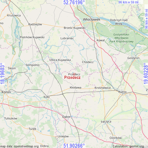
Przedecz GPS coordinates[2]
52° 20' 3.84" North, 18° 53' 56.94" East
| Map corner | latitude | longitude |
|---|---|---|
| Upper-left | 52.76196°, | 18.19603° |
| Center: | 52.3344°, | 18.89915° |
| Lower-right: | 51.90266°, | 19.60228° |
| Map W x H: | 95.5×95.5 km | = 59.3×59.3mi |
| max Lat: | 54.83135° ⇑26.6% North |
| Przedecz: | 52.3344° |
| min Lat: | ⇓73.4% South 49.21328° |
| min Long | Przedecz | max Long |
| 14.20249° | 18.89915° | 24.03723° |
| W 38%⇐ | ⇒62% E |
Elevation
Elevation of Przedecz is 114 m = 374 ft, and this is 77.4 m = 254 ft below average elevation for this country.
| Max E: |
974 m = 3196 ft | 73.5% |
| Avg. | 191.4 m = 628 ft | |
| Przedecz | 114 m = 374 ft | |
Min E: |
-3 m = -10 ft | 26.5% |
See also: Poland elevation on elevation.city.
Geographical zone
Przedecz is located in North temperate zone (between Tropic of Cancer and the Arctic Circle). Distance of this North polar circle is 1582.1 km =983.1 mi to North.| Distance of | km | miles | from Przedecz |
|---|---|---|---|
| North Pole | 4188 | 2602.3 | to North |
| Arctic Circle | 1582.1 | 983.1 | to North |
| Tropic Cancer | 3213.1 | 1996.5 | to South |
| Equator | 5819 | 3615.8 | to South |


Nearby cities:
15 places around Przedecz: (largest is in red/bold)
• Babiak
15.8 km =9.8 mi,  274°
274°
• Boniewo
14.6 km =9.1 mi,  357°
357°
• Brdów
11.7 km =7.3 mi,  280°
280°
• Choceń
18.6 km =11.6 mi,  24°
24°
• Chodecz
11.7 km =7.3 mi,  47°
47°
• Chodów
12.2 km =7.6 mi,  140°
140°
• Dąbrowice
12.8 km =8 mi,  101°
101°
• Grzegorzew
18.5 km =11.5 mi,  217°
217°
• Izbica Kujawska
13.3 km =8.3 mi,  316°
316°
• Kaliska
17.1 km =10.6 mi,  61°
61°
• Kłodawa
8.9 km =5.5 mi,  173°
173°
• Lubień Kujawski
19.7 km =12.2 mi,  66°
66°
• Nowe Ostrowy
20.2 km =12.6 mi, 99°
• Olszówka
16.2 km =10.1 mi,  188°
188°
• Ostrowy
18.4 km =11.4 mi, 100°
Sources, notices
• [Note1] Compared only with cities in Poland existing in our database
• [Src1] Map data: © OpenStreetMap contributors (CC-BY-SA)
• [Src2] Other city data from geonames.org with taken over terms of usage.
• [Src3] Geographical zone / Annual Mean Temperature by Robert A. Rohde @ Wikipedia
