Chodów geodata
Chodów (Greater Poland) is a seat of a third-order administrative division; located in Poland in Europe/Warsaw (GMT+2) time zone. With population of 830 people, there are 2797 cities with bigger population in this country. Compared to other cities in Poland, 71.3% of cities are located further ↓South; 59.9% of cities are located further →East and 71.1% of cities have higher elevation than Chodów. Note1


Chodów GPS coordinates[2]
52° 14' 58.596" North, 19° 0' 43.848" East
| Map corner | latitude | longitude |
|---|---|---|
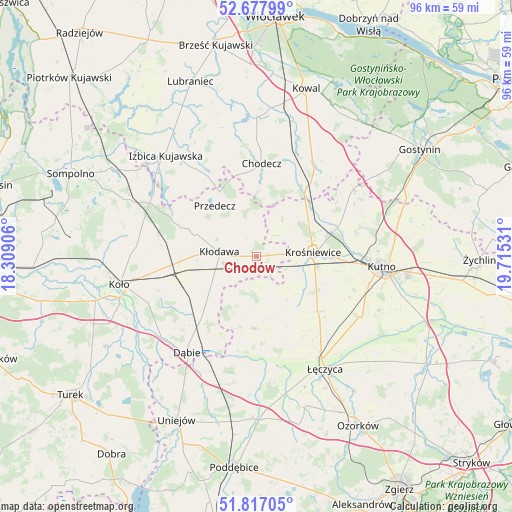
| Upper-left | 52.67799°, | 18.30906° |
| Center: | 52.24961°, | 19.01218° |
| Lower-right: | 51.81705°, | 19.71531° |
| Map W x H: | 95.7×95.7 km | = 59.5×59.5mi |
| max Lat: | 54.83135° ⇑28.7% North |
| Chodów: | 52.24961° |
| min Lat: | ⇓71.3% South 49.21328° |
| min Long | Chodów | max Long |
| 14.20249° | 19.01218° | 24.03723° |
| W 40.1%⇐ | ⇒59.9% E |
Elevation
Elevation of Chodów is 119 m = 390 ft, and this is 72.4 m = 238 ft below average elevation for this country.
| Max E: |
974 m = 3196 ft | 71.1% |
| Avg. | 191.4 m = 628 ft | |
| Chodów | 119 m = 390 ft | |
Min E: |
-3 m = -10 ft | 28.9% |
See also: Poland elevation on elevation.city.
Geographical zone
Chodów is located in North temperate zone (between Tropic of Cancer and the Arctic Circle). Distance of this North polar circle is 1591.6 km =989 mi to North.| Distance of | km | miles | from Chodów |
|---|---|---|---|
| North Pole | 4197.4 | 2608.1 | to North |
| Arctic Circle | 1591.6 | 989 | to North |
| Tropic Cancer | 3203.7 | 1990.7 | to South |
| Equator | 5809.6 | 3609.9 | to South |


Nearby cities:
15 places around Chodów: (largest is in red/bold)
• Błonie
21 km =13 mi,  156°
156°
• Chodecz
17.3 km =10.7 mi,  3°
3°
• Daszyna
15.6 km =9.7 mi,  132°
132°
• Dąbrowice
8.4 km =5.2 mi,  35°
35°
• Grabów
13.6 km =8.5 mi,  182°
182°
• Grzegorzew
19.7 km =12.2 mi,  254°
254°
• Kaliska
19.1 km =11.9 mi,  22°
22°
• Krośniewice
10.8 km =6.7 mi,  86°
86°
• Kłodawa
6.7 km =4.2 mi,  274°
274°
• Lubień Kujawski
20.2 km =12.6 mi,  30°
30°
• Nowe Ostrowy
13.6 km =8.5 mi,  64°
64°
• Olszówka
12.1 km =7.5 mi,  237°
237°
• Ostrowy
12.1 km =7.5 mi, 59°
• Przedecz
12.2 km =7.6 mi,  320°
320°
• Łanięta
22.1 km =13.7 mi, 55°
Sources, notices
• [Note1] Compared only with cities in Poland existing in our database
• [Src1] Map data: © OpenStreetMap contributors (CC-BY-SA)
• [Src2] Other city data from geonames.org with taken over terms of usage.
• [Src3] Geographical zone / Annual Mean Temperature by Robert A. Rohde @ Wikipedia
