Połajewo geodata
Połajewo (Greater Poland) is a seat of a third-order administrative division; located in Poland in Europe/Warsaw (GMT+2) time zone. With population of 2,237 people, there are 1341 cities with bigger population in this country. Compared to other cities in Poland, 80.9% of cities are located further ↓South; 87.8% of cities are located further →East and 89.9% of cities have higher elevation than Połajewo. Note1
Administrative division(s):
- Level 1: Greater Poland
- Level 2: Powiat czarnkowsko-trzcianecki
- Level 3: Połajewo


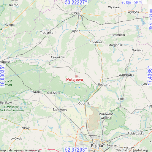
Połajewo GPS coordinates[2]
52° 47' 57.228" North, 16° 44' 0.492" East
| Map corner | latitude | longitude |
|---|---|---|
| Upper-left | 53.22227°, | 16.03035° |
| Center: | 52.79923°, | 16.73347° |
| Lower-right: | 52.37203°, | 17.4366° |
| Map W x H: | 94.5×94.5 km | = 58.7×58.7mi |
| max Lat: | 54.83135° ⇑19.1% North |
| Połajewo: | 52.79923° |
| min Lat: | ⇓80.9% South 49.21328° |
| min Long | Połajewo | max Long |
| 14.20249° | 16.73347° | 24.03723° |
| W 12.2%⇐ | ⇒87.8% E |
Elevation
Elevation of Połajewo is 76 m = 249 ft, and this is 115.4 m = 379 ft below average elevation for this country.
| Max E: |
974 m = 3196 ft | 89.9% |
| Avg. | 191.4 m = 628 ft | |
| Połajewo | 76 m = 249 ft | |
Min E: |
-3 m = -10 ft | 10.1% |
See also: Poland elevation on elevation.city.
Geographical zone
Połajewo is located in North temperate zone (between Tropic of Cancer and the Arctic Circle). Distance of this North polar circle is 1530.5 km =951 mi to North.| Distance of | km | miles | from Połajewo |
|---|---|---|---|
| North Pole | 4136.3 | 2570.2 | to North |
| Arctic Circle | 1530.5 | 951 | to North |
| Tropic Cancer | 3264.8 | 2028.7 | to South |
| Equator | 5870.7 | 3647.9 | to South |


Nearby cities:
15 places around Połajewo: (largest is in red/bold)
• Budzyń
19.8 km =12.3 mi,  59°
59°
• Chodzież
25.1 km =15.6 mi,  29°
29°
• Czarnków
16.1 km =10 mi,  315°
315°
• Lipnica
30.6 km =19 mi,  213°
213°
• Lubasz
15.3 km =9.5 mi,  292°
292°
• Objezierze
21.7 km =13.5 mi,  174°
174°
• Oborniki
17.7 km =11 mi,  162°
162°
• Obrzycko
17.5 km =10.9 mi,  232°
232°
• Ostroróg
27.1 km =16.8 mi,  224°
224°
• Pamiątkowo
27.6 km =17.1 mi,  187°
187°
• Rogoźno
18.1 km =11.2 mi,  106°
106°
• Ryczywół
6.7 km =4.2 mi,  76°
76°
• Szamotuły
23.3 km =14.5 mi, 206°
• Ujście
28.3 km =17.6 mi,  359°
359°
• Wronki
25.7 km =16 mi,  247°
247°
Sources, notices
• [Note1] Compared only with cities in Poland existing in our database
• [Src1] Map data: © OpenStreetMap contributors (CC-BY-SA)
• [Src2] Other city data from geonames.org with taken over terms of usage.
• [Src3] Geographical zone / Annual Mean Temperature by Robert A. Rohde @ Wikipedia
