Nowy Tomyśl geodata
Nowy Tomyśl (Greater Poland) is a seat of a third-order administrative division; located in Poland in Europe/Warsaw (GMT+2) time zone. With population of 15,179 people, there are 328 cities with bigger population in this country. Compared to other cities in Poland, 73% of cities are located further ↓South; 91.8% of cities are located further →East and 90.3% of cities have higher elevation than Nowy Tomyśl. Note1
Administrative division(s):
- Level 1: Greater Poland
- Level 2: Powiat nowotomyski
- Level 3: Nowy Tomyśl


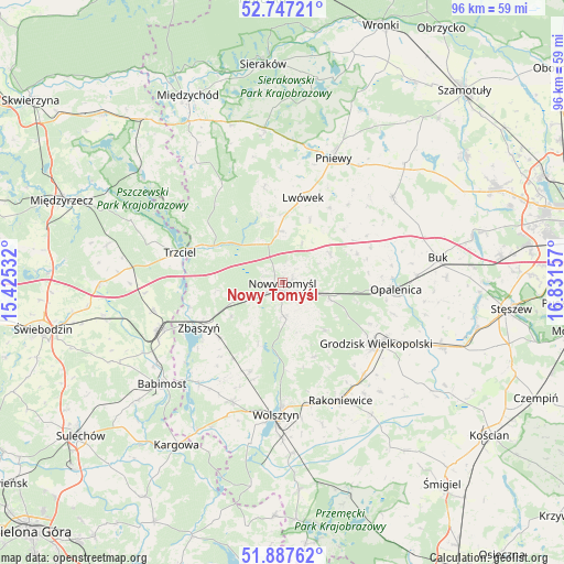
Nowy Tomyśl GPS coordinates[2]
52° 19' 10.2" North, 16° 7' 42.384" East
| Map corner | latitude | longitude |
|---|---|---|
| Upper-left | 52.74721°, | 15.42532° |
| Center: | 52.3195°, | 16.12844° |
| Lower-right: | 51.88762°, | 16.83157° |
| Map W x H: | 95.6×95.6 km | = 59.4×59.4mi |
| max Lat: | 54.83135° ⇑27% North |
| Nowy Tomyśl: | 52.3195° |
| min Lat: | ⇓73% South 49.21328° |
| min Long | Nowy Tomyśl | max Long |
| 14.20249° | 16.12844° | 24.03723° |
| W 8.2%⇐ | ⇒91.8% E |
Elevation
Elevation of Nowy Tomyśl is 74 m = 243 ft, and this is 117.4 m = 385 ft below average elevation for this country.
| Max E: |
974 m = 3196 ft | 90.3% |
| Avg. | 191.4 m = 628 ft | |
| Nowy Tomyśl | 74 m = 243 ft | |
Min E: |
-3 m = -10 ft | 9.7% |
See also: Poland elevation on elevation.city.
Geographical zone
Nowy Tomyśl is located in North temperate zone (between Tropic of Cancer and the Arctic Circle). Distance of this North polar circle is 1583.8 km =984.1 mi to North.| Distance of | km | miles | from Nowy Tomyśl |
|---|---|---|---|
| North Pole | 4189.7 | 2603.4 | to North |
| Arctic Circle | 1583.8 | 984.1 | to North |
| Tropic Cancer | 3211.5 | 1995.5 | to South |
| Equator | 5817.4 | 3614.8 | to South |


Nearby cities:
15 places around Nowy Tomyśl: (largest is in red/bold)
• Brody
17.4 km =10.8 mi,  40°
40°
• Grodzisk Wielkopolski
19.1 km =11.9 mi,  122°
122°
• Jabłonna
13.7 km =8.5 mi,  156°
156°
• Kuślin
13.6 km =8.5 mi,  68°
68°
• Lwówek
14.7 km =9.1 mi,  14°
14°
• Miedzichowo
13.1 km =8.1 mi,  298°
298°
• Opalenica
19.4 km =12.1 mi,  93°
93°
• Pakosław
15.1 km =9.4 mi,  32°
32°
• Pniewy
22.8 km =14.2 mi,  22°
22°
• Rakoniewice
22.4 km =13.9 mi,  153°
153°
• Siedlec
21.9 km =13.6 mi,  202°
202°
• Trzciel
18.1 km =11.2 mi,  286°
286°
• Wolsztyn
22.7 km =14.1 mi,  181°
181°
• Zbąszynek
22.9 km =14.2 mi,  248°
248°
• Zbąszyń
15.8 km =9.8 mi,  241°
241°
Sources, notices
• [Note1] Compared only with cities in Poland existing in our database
• [Src1] Map data: © OpenStreetMap contributors (CC-BY-SA)
• [Src2] Other city data from geonames.org with taken over terms of usage.
• [Src3] Geographical zone / Annual Mean Temperature by Robert A. Rohde @ Wikipedia
