Rakoniewice geodata
Rakoniewice (Greater Poland) is a seat of a third-order administrative division; located in Poland in Europe/Warsaw (GMT+2) time zone. With population of 3,322 people, there are 961 cities with bigger population in this country. Compared to other cities in Poland, 68.6% of cities are located further ↓South; 90.9% of cities are located further →East and 79.3% of cities have higher elevation than Rakoniewice. Note1


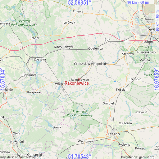
Rakoniewice GPS coordinates[2]
52° 8' 20.616" North, 16° 16' 24.456" East
| Map corner | latitude | longitude |
|---|---|---|
| Upper-left | 52.56851°, | 15.57034° |
| Center: | 52.13906°, | 16.27346° |
| Lower-right: | 51.70543°, | 16.97659° |
| Map W x H: | 96×96 km | = 59.7×59.7mi |
| max Lat: | 54.83135° ⇑31.4% North |
| Rakoniewice: | 52.13906° |
| min Lat: | ⇓68.6% South 49.21328° |
| min Long | Rakoniewice | max Long |
| 14.20249° | 16.27346° | 24.03723° |
| W 9.1%⇐ | ⇒90.9% E |
Elevation
Elevation of Rakoniewice is 101 m = 331 ft, and this is 90.4 m = 297 ft below average elevation for this country.
| Max E: |
974 m = 3196 ft | 79.3% |
| Avg. | 191.4 m = 628 ft | |
| Rakoniewice | 101 m = 331 ft | |
Min E: |
-3 m = -10 ft | 20.7% |
See also: Poland elevation on elevation.city.
Geographical zone
Rakoniewice is located in North temperate zone (between Tropic of Cancer and the Arctic Circle). Distance of this North polar circle is 1603.9 km =996.6 mi to North.| Distance of | km | miles | from Rakoniewice |
|---|---|---|---|
| North Pole | 4209.7 | 2615.8 | to North |
| Arctic Circle | 1603.9 | 996.6 | to North |
| Tropic Cancer | 3191.4 | 1983 | to South |
| Equator | 5797.3 | 3602.3 | to South |


Nearby cities:
15 places around Rakoniewice: (largest is in red/bold)
• Brenno
24.4 km =15.2 mi,  189°
189°
• Granowo
19.7 km =12.2 mi,  61°
61°
• Grodzisk Wielkopolski
11.7 km =7.3 mi,  32°
32°
• Jabłonna
8.7 km =5.4 mi,  328°
328°
• Kamieniec
13.2 km =8.2 mi,  76°
76°
• Kuślin
25.2 km =15.7 mi,  6°
6°
• Nowy Tomyśl
22.4 km =13.9 mi, 333°
• Opalenica
21.1 km =13.1 mi, 26°
• Przemęt
14.7 km =9.1 mi,  172°
172°
• Siedlec
18.5 km =11.5 mi,  269°
269°
• Wielichowo
5.9 km =3.7 mi,  115°
115°
• Wijewo
25.5 km =15.8 mi, 193°
• Wolsztyn
11 km =6.8 mi,  256°
256°
• Włoszakowice
24.3 km =15.1 mi, 165°
• Śmigiel
22.3 km =13.9 mi,  128°
128°
Sources, notices
• [Note1] Compared only with cities in Poland existing in our database
• [Src1] Map data: © OpenStreetMap contributors (CC-BY-SA)
• [Src2] Other city data from geonames.org with taken over terms of usage.
• [Src3] Geographical zone / Annual Mean Temperature by Robert A. Rohde @ Wikipedia
