Kuślin geodata
Kuślin (Greater Poland) is a seat of a third-order administrative division; located in Poland in Europe/Warsaw (GMT+2) time zone. With population of 558 people, there are 3390 cities with bigger population in this country. Compared to other cities in Poland, 73.9% of cities are located further ↓South; 90.7% of cities are located further →East and 85.7% of cities have higher elevation than Kuślin. Note1


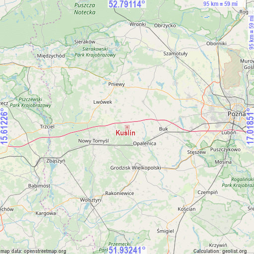
Kuślin GPS coordinates[2]
52° 21' 49.896" North, 16° 18' 55.368" East
| Map corner | latitude | longitude |
|---|---|---|
| Upper-left | 52.79114°, | 15.61226° |
| Center: | 52.36386°, | 16.31538° |
| Lower-right: | 51.93241°, | 17.01851° |
| Map W x H: | 95.5×95.5 km | = 59.3×59.3mi |
| max Lat: | 54.83135° ⇑26.1% North |
| Kuślin: | 52.36386° |
| min Lat: | ⇓73.9% South 49.21328° |
| min Long | Kuślin | max Long |
| 14.20249° | 16.31538° | 24.03723° |
| W 9.3%⇐ | ⇒90.7% E |
Elevation
Elevation of Kuślin is 88 m = 289 ft, and this is 103.4 m = 339 ft below average elevation for this country.
| Max E: |
974 m = 3196 ft | 85.7% |
| Avg. | 191.4 m = 628 ft | |
| Kuślin | 88 m = 289 ft | |
Min E: |
-3 m = -10 ft | 14.3% |
See also: Poland elevation on elevation.city.
Geographical zone
Kuślin is located in North temperate zone (between Tropic of Cancer and the Arctic Circle). Distance of this North polar circle is 1578.9 km =981.1 mi to North.| Distance of | km | miles | from Kuślin |
|---|---|---|---|
| North Pole | 4184.7 | 2600.3 | to North |
| Arctic Circle | 1578.9 | 981.1 | to North |
| Tropic Cancer | 3216.4 | 1998.6 | to South |
| Equator | 5822.3 | 3617.8 | to South |


Nearby cities:
15 places around Kuślin: (largest is in red/bold)
• Brody
8.4 km =5.2 mi,  350°
350°
• Buk
13.9 km =8.6 mi,  93°
93°
• Dopiewo
24.5 km =15.2 mi, 91°
• Duszniki
11.1 km =6.9 mi,  33°
33°
• Granowo
21.4 km =13.3 mi,  137°
137°
• Grodzisk Wielkopolski
15.5 km =9.6 mi,  167°
167°
• Jabłonna
19 km =11.8 mi,  202°
202°
• Kamieniec
24.1 km =15 mi,  155°
155°
• Kaźmierz
24.6 km =15.3 mi,  47°
47°
• Lwówek
13.1 km =8.1 mi,  315°
315°
• Miedzichowo
24.2 km =15 mi,  273°
273°
• Nowy Tomyśl
13.6 km =8.5 mi,  248°
248°
• Opalenica
9 km =5.6 mi,  132°
132°
• Pakosław
9.1 km =5.7 mi,  329°
329°
• Pniewy
16.7 km =10.4 mi, 346°
Sources, notices
• [Note1] Compared only with cities in Poland existing in our database
• [Src1] Map data: © OpenStreetMap contributors (CC-BY-SA)
• [Src2] Other city data from geonames.org with taken over terms of usage.
• [Src3] Geographical zone / Annual Mean Temperature by Robert A. Rohde @ Wikipedia
