Męcinka geodata
Męcinka (Lower Silesia) is a populated place; located in Poland in Europe/Warsaw (GMT+2) time zone. With population of 747 people, there are 2976 cities with bigger population in this country. Compared to other cities in Poland, 53.4% of cities are located further ↑North; 91.9% of cities are located further →East and 65.3% of cities have lower elevation than Męcinka. Note1


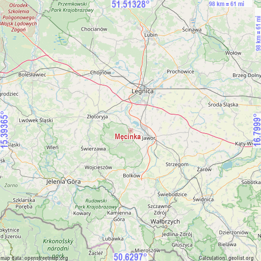
Męcinka GPS coordinates[2]
51° 4' 24.96" North, 16° 5' 48.372" East
| Map corner | latitude | longitude |
|---|---|---|
| Upper-left | 51.51328°, | 15.39365° |
| Center: | 51.0736°, | 16.09677° |
| Lower-right: | 50.6297°, | 16.7999° |
| Map W x H: | 98.2×98.2 km | = 61×61mi |
| max Lat: | 54.83135° ⇑53.4% North |
| Męcinka: | 51.0736° |
| min Lat: | ⇓46.6% South 49.21328° |
| min Long | Męcinka | max Long |
| 14.20249° | 16.09677° | 24.03723° |
| W 8.1%⇐ | ⇒91.9% E |
Elevation
Elevation of Męcinka is 215 m = 705 ft, and this is 23.6 m = 77 ft above average elevation for this country.
| Max E: |
974 m = 3196 ft | 34.7% |
| Męcinka | 215 m 705 ft | |
| Avg. | 191.4 m = 628 ft | |
Min E: |
-3 m = -10 ft | 65.3% |
See also: Poland elevation on elevation.city.
Geographical zone
Męcinka is located in North temperate zone (between Tropic of Cancer and the Arctic Circle). Distance of this North polar circle is 1722.3 km =1070.2 mi to North.| Distance of | km | miles | from Męcinka |
|---|---|---|---|
| North Pole | 4328.2 | 2689.4 | to North |
| Arctic Circle | 1722.3 | 1070.2 | to North |
| Tropic Cancer | 3072.9 | 1909.4 | to South |
| Equator | 5678.9 | 3528.7 | to South |


Nearby cities:
15 places around Męcinka: (largest is in red/bold)
• Bolków
16.9 km =10.5 mi,  178°
178°
• Jawor
7.2 km =4.5 mi,  110°
110°
• Krotoszyce
8.9 km =5.5 mi,  336°
336°
• Kunice
19.6 km =12.2 mi,  32°
32°
• Legnica
15.8 km =9.8 mi,  16°
16°
• Legnickie Pole
12.8 km =8 mi,  52°
52°
• Mierczyce
15.3 km =9.5 mi,  81°
81°
• Paszowice
8 km =5 mi,  150°
150°
• Sędziszowa
16.3 km =10.1 mi,  251°
251°
• Wierzchosławice
20.3 km =12.6 mi, 180°
• Wilków
12 km =7.5 mi,  279°
279°
• Wojcieszów
18.2 km =11.3 mi,  222°
222°
• Wądroże Wielkie
17.1 km =10.6 mi,  73°
73°
• Złotoryja
13.7 km =8.5 mi,  295°
295°
• Świerzawa
15.6 km =9.7 mi,  244°
244°
Sources, notices
• [Note1] Compared only with cities in Poland existing in our database
• [Src1] Map data: © OpenStreetMap contributors (CC-BY-SA)
• [Src2] Other city data from geonames.org with taken over terms of usage.
• [Src3] Geographical zone / Annual Mean Temperature by Robert A. Rohde @ Wikipedia
