Mierczyce geodata
Mierczyce (Lower Silesia) is a populated place; located in Poland in Europe/Warsaw (GMT+2) time zone. With population of 688 people, there are 3093 cities with bigger population in this country. Compared to other cities in Poland, 52.8% of cities are located further ↑North; 90.7% of cities are located further →East and 55.3% of cities have higher elevation than Mierczyce. Note1
Administrative division(s):
- Level 1: Lower Silesia
- Level 2: Powiat jaworski
- Level 3: Wądroże Wielkie


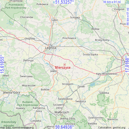
Mierczyce GPS coordinates[2]
51° 5' 35.052" North, 16° 18' 49.212" East
| Map corner | latitude | longitude |
|---|---|---|
| Upper-left | 51.53257°, | 15.61055° |
| Center: | 51.09307°, | 16.31367° |
| Lower-right: | 50.64936°, | 17.0168° |
| Map W x H: | 98.2×98.2 km | = 61×61mi |
| max Lat: | 54.83135° ⇑52.8% North |
| Mierczyce: | 51.09307° |
| min Lat: | ⇓47.2% South 49.21328° |
| min Long | Mierczyce | max Long |
| 14.20249° | 16.31367° | 24.03723° |
| W 9.3%⇐ | ⇒90.7% E |
Elevation
Elevation of Mierczyce is 158 m = 518 ft, and this is 33.4 m = 110 ft below average elevation for this country.
| Max E: |
974 m = 3196 ft | 55.3% |
| Avg. | 191.4 m = 628 ft | |
| Mierczyce | 158 m = 518 ft | |
Min E: |
-3 m = -10 ft | 44.7% |
See also: Poland elevation on elevation.city.
Geographical zone
Mierczyce is located in North temperate zone (between Tropic of Cancer and the Arctic Circle). Distance of this North polar circle is 1720.2 km =1068.9 mi to North.| Distance of | km | miles | from Mierczyce |
|---|---|---|---|
| North Pole | 4326 | 2688.1 | to North |
| Arctic Circle | 1720.2 | 1068.9 | to North |
| Tropic Cancer | 3075.1 | 1910.8 | to South |
| Equator | 5681 | 3530 | to South |


Nearby cities:
15 places around Mierczyce: (largest is in red/bold)
• Ciechów
18.3 km =11.4 mi,  76°
76°
• Jawor
9.6 km =6 mi,  241°
241°
• Konary
7.9 km =4.9 mi,  136°
136°
• Krotoszyce
19.6 km =12.2 mi,  287°
287°
• Kunice
15.1 km =9.4 mi,  342°
342°
• Legnica
16.8 km =10.4 mi,  320°
320°
• Legnickie Pole
7.6 km =4.7 mi, 318°
• Malczyce
18.9 km =11.7 mi,  41°
41°
• Męcinka
15.3 km =9.5 mi,  261°
261°
• Paszowice
14.5 km =9 mi,  230°
230°
• Prochowice
20.3 km =12.6 mi,  10°
10°
• Stanowice
18.5 km =11.5 mi,  166°
166°
• Strzegom
14.7 km =9.1 mi, 170°
• Udanin
11.6 km =7.2 mi,  122°
122°
• Wądroże Wielkie
3 km =1.9 mi,  26°
26°
Sources, notices
• [Note1] Compared only with cities in Poland existing in our database
• [Src1] Map data: © OpenStreetMap contributors (CC-BY-SA)
• [Src2] Other city data from geonames.org with taken over terms of usage.
• [Src3] Geographical zone / Annual Mean Temperature by Robert A. Rohde @ Wikipedia
