Łanięta geodata
Łanięta (Łódź Voivodeship) is a seat of a third-order administrative division; located in Poland in Europe/Warsaw (GMT+2) time zone. With population of 634 people, there are 3199 cities with bigger population in this country. Compared to other cities in Poland, 73.9% of cities are located further ↓South; 54.6% of cities are located further →East and 67.1% of cities have higher elevation than Łanięta. Note1


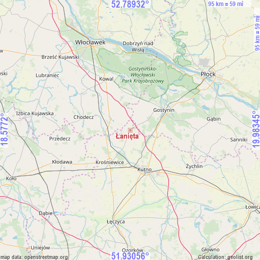
Łanięta GPS coordinates[2]
52° 21' 43.308" North, 19° 16' 49.152" East
| Map corner | latitude | longitude |
|---|---|---|
| Upper-left | 52.78932°, | 18.5772° |
| Center: | 52.36203°, | 19.28032° |
| Lower-right: | 51.93056°, | 19.98345° |
| Map W x H: | 95.5×95.5 km | = 59.3×59.3mi |
| max Lat: | 54.83135° ⇑26.1% North |
| Łanięta: | 52.36203° |
| min Lat: | ⇓73.9% South 49.21328° |
| min Long | Łanięta | max Long |
| 14.20249° | 19.28032° | 24.03723° |
| W 45.4%⇐ | ⇒54.6% E |
Elevation
Elevation of Łanięta is 128 m = 420 ft, and this is 63.4 m = 208 ft below average elevation for this country.
| Max E: |
974 m = 3196 ft | 67.1% |
| Avg. | 191.4 m = 628 ft | |
| Łanięta | 128 m = 420 ft | |
Min E: |
-3 m = -10 ft | 32.9% |
See also: Poland elevation on elevation.city.
Geographical zone
Łanięta is located in North temperate zone (between Tropic of Cancer and the Arctic Circle). Distance of this North polar circle is 1579.1 km =981.2 mi to North.| Distance of | km | miles | from Łanięta |
|---|---|---|---|
| North Pole | 4184.9 | 2600.4 | to North |
| Arctic Circle | 1579.1 | 981.2 | to North |
| Tropic Cancer | 3216.2 | 1998.5 | to South |
| Equator | 5822.1 | 3617.7 | to South |


Nearby cities:
15 places around Łanięta: (largest is in red/bold)
• Baruchowo
14.7 km =9.1 mi,  355°
355°
• Chodecz
17.8 km =11.1 mi,  285°
285°
• Chodów
22.1 km =13.7 mi,  235°
235°
• Czerniewice
21.2 km =13.2 mi,  321°
321°
• Dąbrowice
14.5 km =9 mi,  247°
247°
• Gostynin
14.4 km =8.9 mi,  58°
58°
• Kaliska
12.1 km =7.5 mi,  295°
295°
• Kowal
20.7 km =12.9 mi,  334°
334°
• Krośniewice
14 km =8.7 mi,  212°
212°
• Kutno
15.7 km =9.8 mi,  158°
158°
• Lubień Kujawski
9.2 km =5.7 mi, 301°
• Nowe Ostrowy
8.9 km =5.5 mi,  222°
222°
• Oporów
22.1 km =13.7 mi,  119°
119°
• Ostrowy
10.1 km =6.3 mi,  230°
230°
• Strzelce
10.1 km =6.3 mi, 121°
Sources, notices
• [Note1] Compared only with cities in Poland existing in our database
• [Src1] Map data: © OpenStreetMap contributors (CC-BY-SA)
• [Src2] Other city data from geonames.org with taken over terms of usage.
• [Src3] Geographical zone / Annual Mean Temperature by Robert A. Rohde @ Wikipedia
