Borkowice geodata
Borkowice (Opole Voivodeship) is a populated place; located in Poland in Europe/Warsaw (GMT+2) time zone. With population of 943 people, there are 2604 cities with bigger population in this country. Compared to other cities in Poland, 56.6% of cities are located further ↑North; 73.3% of cities are located further →East and 56% of cities have lower elevation than Borkowice. Note1
Administrative division(s):
- Level 1: Opole Voivodeship
- Level 2: Powiat kluczborski
- Level 3: Kluczbork


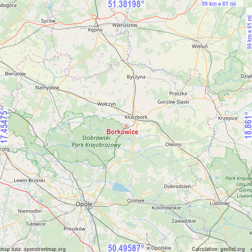
Borkowice GPS coordinates[2]
50° 56' 27.744" North, 18° 9' 28.332" East
| Map corner | latitude | longitude |
|---|---|---|
| Upper-left | 51.38198°, | 17.45475° |
| Center: | 50.94104°, | 18.15787° |
| Lower-right: | 50.49587°, | 18.861° |
| Map W x H: | 98.5×98.5 km | = 61.2×61.2mi |
| max Lat: | 54.83135° ⇑56.6% North |
| Borkowice: | 50.94104° |
| min Lat: | ⇓43.4% South 49.21328° |
| min Long | Borkowice | max Long |
| 14.20249° | 18.15787° | 24.03723° |
| W 26.7%⇐ | ⇒73.3% E |
Elevation
Elevation of Borkowice is 188 m = 617 ft, and this is 3.4 m = 11 ft below average elevation for this country.
| Max E: |
974 m = 3196 ft | 44% |
| Avg. | 191.4 m = 628 ft | |
| Borkowice | 188 m = 617 ft | |
Min E: |
-3 m = -10 ft | 56% |
See also: Poland elevation on elevation.city.
Geographical zone
Borkowice is located in North temperate zone (between Tropic of Cancer and the Arctic Circle). Distance of this North polar circle is 1737.1 km =1079.4 mi to North.| Distance of | km | miles | from Borkowice |
|---|---|---|---|
| North Pole | 4342.9 | 2698.6 | to North |
| Arctic Circle | 1737.1 | 1079.4 | to North |
| Tropic Cancer | 3058.2 | 1900.3 | to South |
| Equator | 5664.1 | 3519.5 | to South |


Nearby cities:
15 places around Borkowice: (largest is in red/bold)
• Bierdzany
13.6 km =8.5 mi,  179°
179°
• Byczyna
19.6 km =12.2 mi,  11°
11°
• Domaradz
20.5 km =12.7 mi,  272°
272°
• Domaszowice
22 km =13.7 mi,  301°
301°
• Gorzów Śląski
21 km =13 mi,  62°
62°
• Kluczbork
5.5 km =3.4 mi,  50°
50°
• Lasowice Małe
7.9 km =4.9 mi,  120°
120°
• Lasowice Wielkie
9.3 km =5.8 mi,  148°
148°
• Murów
17.2 km =10.7 mi,  239°
239°
• Olesno
19.8 km =12.3 mi,  111°
111°
• Pokój
22.9 km =14.2 mi,  259°
259°
• Turawa
23 km =14.3 mi,  194°
194°
• Wojciechów
17.1 km =10.6 mi, 106°
• Wołczyn
11.5 km =7.1 mi,  318°
318°
• Łubniany
20.5 km =12.7 mi,  212°
212°
Sources, notices
• [Note1] Compared only with cities in Poland existing in our database
• [Src1] Map data: © OpenStreetMap contributors (CC-BY-SA)
• [Src2] Other city data from geonames.org with taken over terms of usage.
• [Src3] Geographical zone / Annual Mean Temperature by Robert A. Rohde @ Wikipedia
