Bobrowniki geodata
Bobrowniki (Lublin) is a populated place; located in Poland in Europe/Warsaw (GMT+2) time zone. With population of 610 people, there are 3248 cities with bigger population in this country. Compared to other cities in Poland, 57.1% of cities are located further ↓South; 84% of cities are located further ←West and 72.1% of cities have higher elevation than Bobrowniki. Note1


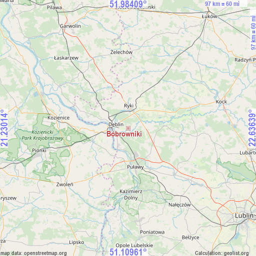
Bobrowniki GPS coordinates[2]
51° 32' 56.22" North, 21° 55' 59.736" East
| Map corner | latitude | longitude |
|---|---|---|
| Upper-left | 51.98409°, | 21.23014° |
| Center: | 51.54895°, | 21.93326° |
| Lower-right: | 51.10961°, | 22.63639° |
| Map W x H: | 97.2×97.2 km | = 60.4×60.4mi |
| max Lat: | 54.83135° ⇑42.9% North |
| Bobrowniki: | 51.54895° |
| min Lat: | ⇓57.1% South 49.21328° |
| min Long | Bobrowniki | max Long |
| 14.20249° | 21.93326° | 24.03723° |
| W 84%⇐ | ⇒16% E |
Elevation
Elevation of Bobrowniki is 117 m = 384 ft, and this is 74.4 m = 244 ft below average elevation for this country.
| Max E: |
974 m = 3196 ft | 72.1% |
| Avg. | 191.4 m = 628 ft | |
| Bobrowniki | 117 m = 384 ft | |
Min E: |
-3 m = -10 ft | 27.9% |
See also: Poland elevation on elevation.city.
Geographical zone
Bobrowniki is located in North temperate zone (between Tropic of Cancer and the Arctic Circle). Distance of this North polar circle is 1669.5 km =1037.4 mi to North.| Distance of | km | miles | from Bobrowniki |
|---|---|---|---|
| North Pole | 4275.4 | 2656.6 | to North |
| Arctic Circle | 1669.5 | 1037.4 | to North |
| Tropic Cancer | 3125.8 | 1942.3 | to South |
| Equator | 5731.7 | 3561.5 | to South |


Nearby cities:
15 places around Bobrowniki: (largest is in red/bold)
• Baranów
14.1 km =8.8 mi,  85°
85°
• Bałtów
9 km =5.6 mi,  136°
136°
• Dęblin
6 km =3.7 mi,  280°
280°
• Gniewoszów
11.8 km =7.3 mi,  225°
225°
• Kawęczyn
18.8 km =11.7 mi,  14°
14°
• Końskowola
17.6 km =10.9 mi,  152°
152°
• Moszczanka
6.1 km =3.8 mi,  21°
21°
• Nowodwór
15.4 km =9.6 mi,  49°
49°
• Podebłocie
16.5 km =10.3 mi,  307°
307°
• Puławy
14.9 km =9.3 mi,  170°
170°
• Ryki
8.5 km =5.3 mi,  359°
359°
• Stężyca
11.8 km =7.3 mi,  288°
288°
• Trojanów
18 km =11.2 mi,  332°
332°
• Ułęż
13 km =8.1 mi,  68°
68°
• Żyrzyn
12.3 km =7.6 mi,  116°
116°
Sources, notices
• [Note1] Compared only with cities in Poland existing in our database
• [Src1] Map data: © OpenStreetMap contributors (CC-BY-SA)
• [Src2] Other city data from geonames.org with taken over terms of usage.
• [Src3] Geographical zone / Annual Mean Temperature by Robert A. Rohde @ Wikipedia
