Wola Dębińska geodata
Wola Dębińska (Lesser Poland) is a populated place; located in Poland in Europe/Warsaw (GMT+2) time zone. With population of 1,602 people, there are 1748 cities with bigger population in this country. Compared to other cities in Poland, 83.6% of cities are located further ↑North; 67.3% of cities are located further ←West and 63.3% of cities have lower elevation than Wola Dębińska. Note1


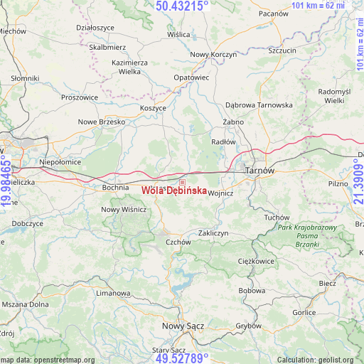
Wola Dębińska GPS coordinates[2]
49° 58' 55.704" North, 20° 41' 15.972" East
| Map corner | latitude | longitude |
|---|---|---|
| Upper-left | 50.43215°, | 19.98465° |
| Center: | 49.98214°, | 20.68777° |
| Lower-right: | 49.52789°, | 21.3909° |
| Map W x H: | 100.5×100.5 km | = 62.4×62.4mi |
| max Lat: | 54.83135° ⇑83.6% North |
| Wola Dębińska: | 49.98214° |
| min Lat: | ⇓16.4% South 49.21328° |
| min Long | Wola Dębińska | max Long |
| 14.20249° | 20.68777° | 24.03723° |
| W 67.3%⇐ | ⇒32.7% E |
Elevation
Elevation of Wola Dębińska is 210 m = 689 ft, and this is 18.6 m = 61 ft above average elevation for this country.
| Max E: |
974 m = 3196 ft | 36.7% |
| Wola Dębińska | 210 m 689 ft | |
| Avg. | 191.4 m = 628 ft | |
Min E: |
-3 m = -10 ft | 63.3% |
See also: Poland elevation on elevation.city.
Geographical zone
Wola Dębińska is located in North temperate zone (between Tropic of Cancer and the Arctic Circle). Distance of this North polar circle is 1843.7 km =1145.6 mi to North.| Distance of | km | miles | from Wola Dębińska |
|---|---|---|---|
| North Pole | 4449.6 | 2764.9 | to North |
| Arctic Circle | 1843.7 | 1145.6 | to North |
| Tropic Cancer | 2951.6 | 1834 | to South |
| Equator | 5557.5 | 3453.3 | to South |


Nearby cities:
15 places around Wola Dębińska: (largest is in red/bold)
• Borzęcin
9.4 km =5.8 mi,  10°
10°
• Brzesko
6 km =3.7 mi,  256°
256°
• Dębno
2.8 km =1.7 mi,  126°
126°
• Jadowniki
4 km =2.5 mi,  230°
230°
• Jasień
8.4 km =5.2 mi, 260°
• Jaworsko
9.6 km =6 mi,  152°
152°
• Maszkienice
0.8 km =0.5 mi,  353°
353°
• Okocim
7.2 km =4.5 mi,  239°
239°
• Porąbka Uszewska
4.4 km =2.7 mi,  177°
177°
• Przyborów
5.6 km =3.5 mi,  341°
341°
• Rudy-Rysie
9.5 km =5.9 mi, 338°
• Sterkowiec
1.5 km =0.9 mi, 340°
• Szczepanów
3.5 km =2.2 mi,  317°
317°
• Wokowice
2.8 km =1.7 mi,  18°
18°
• Łoniowa
7.3 km =4.5 mi, 176°
Sources, notices
• [Note1] Compared only with cities in Poland existing in our database
• [Src1] Map data: © OpenStreetMap contributors (CC-BY-SA)
• [Src2] Other city data from geonames.org with taken over terms of usage.
• [Src3] Geographical zone / Annual Mean Temperature by Robert A. Rohde @ Wikipedia
