Rudy-Rysie geodata
Rudy-Rysie (Lesser Poland) is a populated place; located in Poland in Europe/Warsaw (GMT+2) time zone. With population of 704 people, there are 3056 cities with bigger population in this country. Compared to other cities in Poland, 79.5% of cities are located further ↑North; 66.8% of cities are located further ←West and 56.8% of cities have lower elevation than Rudy-Rysie. Note1


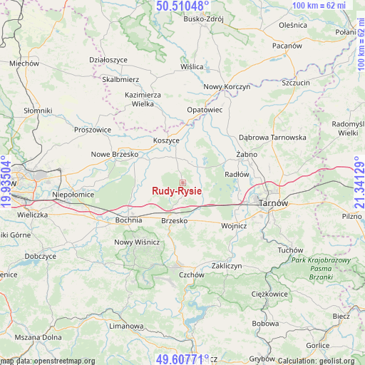
Rudy-Rysie GPS coordinates[2]
50° 3' 40.392" North, 20° 38' 17.376" East
| Map corner | latitude | longitude |
|---|---|---|
| Upper-left | 50.51048°, | 19.93504° |
| Center: | 50.06122°, | 20.63816° |
| Lower-right: | 49.60771°, | 21.34129° |
| Map W x H: | 100.4×100.4 km | = 62.4×62.4mi |
| max Lat: | 54.83135° ⇑79.5% North |
| Rudy-Rysie: | 50.06122° |
| min Lat: | ⇓20.5% South 49.21328° |
| min Long | Rudy-Rysie | max Long |
| 14.20249° | 20.63816° | 24.03723° |
| W 66.8%⇐ | ⇒33.2% E |
Elevation
Elevation of Rudy-Rysie is 190 m = 623 ft, and this is 1.4 m = 5 ft below average elevation for this country.
| Max E: |
974 m = 3196 ft | 43.2% |
| Avg. | 191.4 m = 628 ft | |
| Rudy-Rysie | 190 m = 623 ft | |
Min E: |
-3 m = -10 ft | 56.8% |
See also: Poland elevation on elevation.city.
Geographical zone
Rudy-Rysie is located in North temperate zone (between Tropic of Cancer and the Arctic Circle). Distance of this North polar circle is 1834.9 km =1140.2 mi to North.| Distance of | km | miles | from Rudy-Rysie |
|---|---|---|---|
| North Pole | 4440.8 | 2759.4 | to North |
| Arctic Circle | 1834.9 | 1140.2 | to North |
| Tropic Cancer | 2960.4 | 1839.5 | to South |
| Equator | 5566.3 | 3458.7 | to South |


Nearby cities:
15 places around Rudy-Rysie: (largest is in red/bold)
• Borek
9.1 km =5.7 mi,  237°
237°
• Borzęcin
5.2 km =3.2 mi,  84°
84°
• Brzesko
10.5 km =6.5 mi,  192°
192°
• Jasień
11.2 km =7 mi,  204°
204°
• Jodłówka
9.9 km =6.2 mi,  220°
220°
• Maszkienice
8.7 km =5.4 mi,  156°
156°
• Przyborów
3.9 km =2.4 mi,  152°
152°
• Sterkowiec
8 km =5 mi, 157°
• Strzelce Wielkie
5.5 km =3.4 mi,  311°
311°
• Szczepanów
6.3 km =3.9 mi,  169°
169°
• Szczurowa
6.4 km =4 mi,  358°
358°
• Uście Solne
10.9 km =6.8 mi, 306°
• Wokowice
7.6 km =4.7 mi,  143°
143°
• Wola Dębińska
9.5 km =5.9 mi, 158°
• Zaborów
10.2 km =6.3 mi,  21°
21°
Sources, notices
• [Note1] Compared only with cities in Poland existing in our database
• [Src1] Map data: © OpenStreetMap contributors (CC-BY-SA)
• [Src2] Other city data from geonames.org with taken over terms of usage.
• [Src3] Geographical zone / Annual Mean Temperature by Robert A. Rohde @ Wikipedia
