Borkowice geodata
Borkowice (Mazovia) is a seat of a third-order administrative division; located in Poland in Europe/Warsaw (GMT+2) time zone. With population of 658 people, there are 3151 cities with bigger population in this country. Compared to other cities in Poland, 53.5% of cities are located further ↓South; 67.3% of cities are located further ←West and 68.4% of cities have lower elevation than Borkowice. Note1


Borkowice GPS coordinates[2]
51° 19' 12.9" North, 20° 41' 0.204" East
| Map corner | latitude | longitude |
|---|---|---|
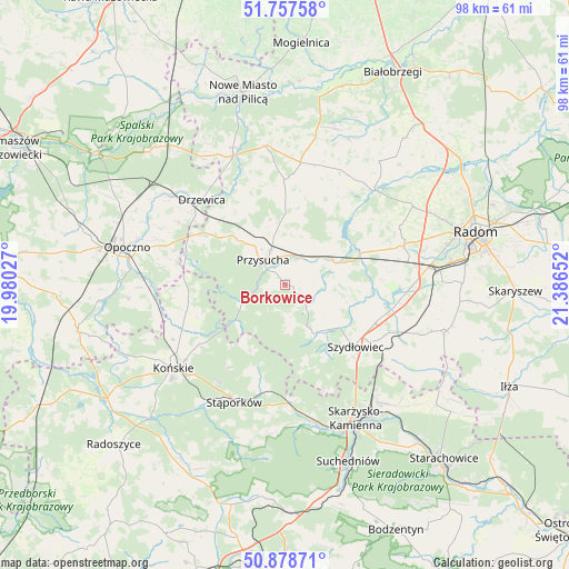
| Upper-left | 51.75758°, | 19.98027° |
| Center: | 51.32025°, | 20.68339° |
| Lower-right: | 50.87871°, | 21.38652° |
| Map W x H: | 97.7×97.7 km | = 60.7×60.7mi |
| max Lat: | 54.83135° ⇑46.5% North |
| Borkowice: | 51.32025° |
| min Lat: | ⇓53.5% South 49.21328° |
| min Long | Borkowice | max Long |
| 14.20249° | 20.68339° | 24.03723° |
| W 67.3%⇐ | ⇒32.7% E |
Elevation
Elevation of Borkowice is 224 m = 735 ft, and this is 32.6 m = 107 ft above average elevation for this country.
| Max E: |
974 m = 3196 ft | 31.6% |
| Borkowice | 224 m 735 ft | |
| Avg. | 191.4 m = 628 ft | |
Min E: |
-3 m = -10 ft | 68.4% |
See also: Poland elevation on elevation.city.
Geographical zone
Borkowice is located in North temperate zone (between Tropic of Cancer and the Arctic Circle). Distance of this North polar circle is 1694.9 km =1053.2 mi to North.| Distance of | km | miles | from Borkowice |
|---|---|---|---|
| North Pole | 4300.8 | 2672.4 | to North |
| Arctic Circle | 1694.9 | 1053.2 | to North |
| Tropic Cancer | 3100.4 | 1926.5 | to South |
| Equator | 5706.3 | 3545.7 | to South |


Nearby cities:
15 places around Borkowice: (largest is in red/bold)
• Chlewiska
10.4 km =6.5 mi,  145°
145°
• Drzewica
20.4 km =12.7 mi,  315°
315°
• Gielniów
16.6 km =10.3 mi,  302°
302°
• Gowarczów
17.7 km =11 mi,  254°
254°
• Jastrząb
20.1 km =12.5 mi,  113°
113°
• Mroczków Gościnny
21.4 km =13.3 mi,  288°
288°
• Orońsko
21.4 km =13.3 mi,  92°
92°
• Pawłów
11.8 km =7.3 mi,  128°
128°
• Potworów
21.1 km =13.1 mi,  7°
7°
• Przysucha
5.7 km =3.5 mi, 318°
• Rusinów
14.6 km =9.1 mi,  332°
332°
• Szydłowiec
16 km =9.9 mi, 129°
• Wielka Wieś
16 km =9.9 mi,  203°
203°
• Wieniawa
9 km =5.6 mi,  59°
59°
• Wolanów
21.5 km =13.4 mi,  71°
71°
Sources, notices
• [Note1] Compared only with cities in Poland existing in our database
• [Src1] Map data: © OpenStreetMap contributors (CC-BY-SA)
• [Src2] Other city data from geonames.org with taken over terms of usage.
• [Src3] Geographical zone / Annual Mean Temperature by Robert A. Rohde @ Wikipedia
