Trojanów geodata
Trojanów (Mazovia) is a seat of a third-order administrative division; located in Poland in Europe/Warsaw (GMT+2) time zone. With population of 686 people, there are 3098 cities with bigger population in this country. Compared to other cities in Poland, 60% of cities are located further ↓South; 82.4% of cities are located further ←West and 61.5% of cities have higher elevation than Trojanów. Note1


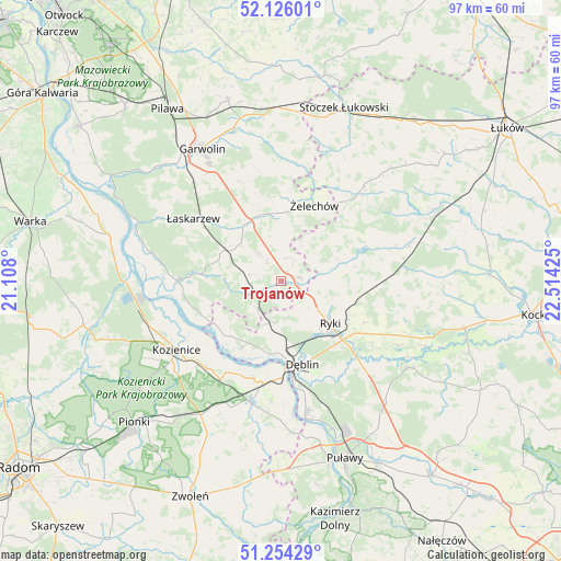
Trojanów GPS coordinates[2]
51° 41' 32.1" North, 21° 48' 40.032" East
| Map corner | latitude | longitude |
|---|---|---|
| Upper-left | 52.12601°, | 21.108° |
| Center: | 51.69225°, | 21.81112° |
| Lower-right: | 51.25429°, | 22.51425° |
| Map W x H: | 96.9×96.9 km | = 60.2×60.2mi |
| max Lat: | 54.83135° ⇑40% North |
| Trojanów: | 51.69225° |
| min Lat: | ⇓60% South 49.21328° |
| min Long | Trojanów | max Long |
| 14.20249° | 21.81112° | 24.03723° |
| W 82.4%⇐ | ⇒17.6% E |
Elevation
Elevation of Trojanów is 143 m = 469 ft, and this is 48.4 m = 159 ft below average elevation for this country.
| Max E: |
974 m = 3196 ft | 61.5% |
| Avg. | 191.4 m = 628 ft | |
| Trojanów | 143 m = 469 ft | |
Min E: |
-3 m = -10 ft | 38.5% |
See also: Poland elevation on elevation.city.
Geographical zone
Trojanów is located in North temperate zone (between Tropic of Cancer and the Arctic Circle). Distance of this North polar circle is 1653.5 km =1027.4 mi to North.| Distance of | km | miles | from Trojanów |
|---|---|---|---|
| North Pole | 4259.4 | 2646.7 | to North |
| Arctic Circle | 1653.5 | 1027.4 | to North |
| Tropic Cancer | 3141.7 | 1952.2 | to South |
| Equator | 5747.6 | 3571.4 | to South |


Nearby cities:
15 places around Trojanów: (largest is in red/bold)
• Bobrowniki
18 km =11.2 mi,  152°
152°
• Dęblin
15 km =9.3 mi,  170°
170°
• Górzno
18.6 km =11.6 mi,  337°
337°
• Kawęczyn
13.3 km =8.3 mi,  79°
79°
• Kobylnica
17 km =10.6 mi,  252°
252°
• Kłoczew
11.1 km =6.9 mi,  73°
73°
• Maciejowice
17.8 km =11.1 mi,  269°
269°
• Moszczanka
14.8 km =9.2 mi,  133°
133°
• Paprotnia
12.3 km =7.6 mi,  236°
236°
• Podebłocie
7.4 km =4.6 mi,  218°
218°
• Ryki
11.2 km =7 mi, 131°
• Sobolew
11.3 km =7 mi,  295°
295°
• Stężyca
12.6 km =7.8 mi,  192°
192°
• Łaskarzew
18.6 km =11.6 mi,  305°
305°
• Żelechów
14.4 km =8.9 mi,  24°
24°
Sources, notices
• [Note1] Compared only with cities in Poland existing in our database
• [Src1] Map data: © OpenStreetMap contributors (CC-BY-SA)
• [Src2] Other city data from geonames.org with taken over terms of usage.
• [Src3] Geographical zone / Annual Mean Temperature by Robert A. Rohde @ Wikipedia
